10.2 Geospatial data processing in SQL - Part 1
Tip
When executing SQL statements in QGIS DB Manager check also Log messages window (PostGIS tab) for possible SQL error messages.
Metadata tables
Geometry_columns
Table geometry_columns describes the available feature tables and
their geometry properties.
Spatial_ref_sys
Table spatial_ref_sys contains coordinate reference system (CRS) definitions.
Let's combine information from geometry_columns and spatial_ref_sys:
select g.f_table_name,g.type,s.srtext from geometry_columns as g
join spatial_ref_sys as s
using (srid);
Geometry vs Geography
Geometry area is computed in map units:
Geography represents feature in geodetic coordinate systems which models the earth using an ellipsoid. Geography calculations are in meters.
Note
Compare computed area on an ellipsoid and projected CRS (EPSG 3035 and 5514):
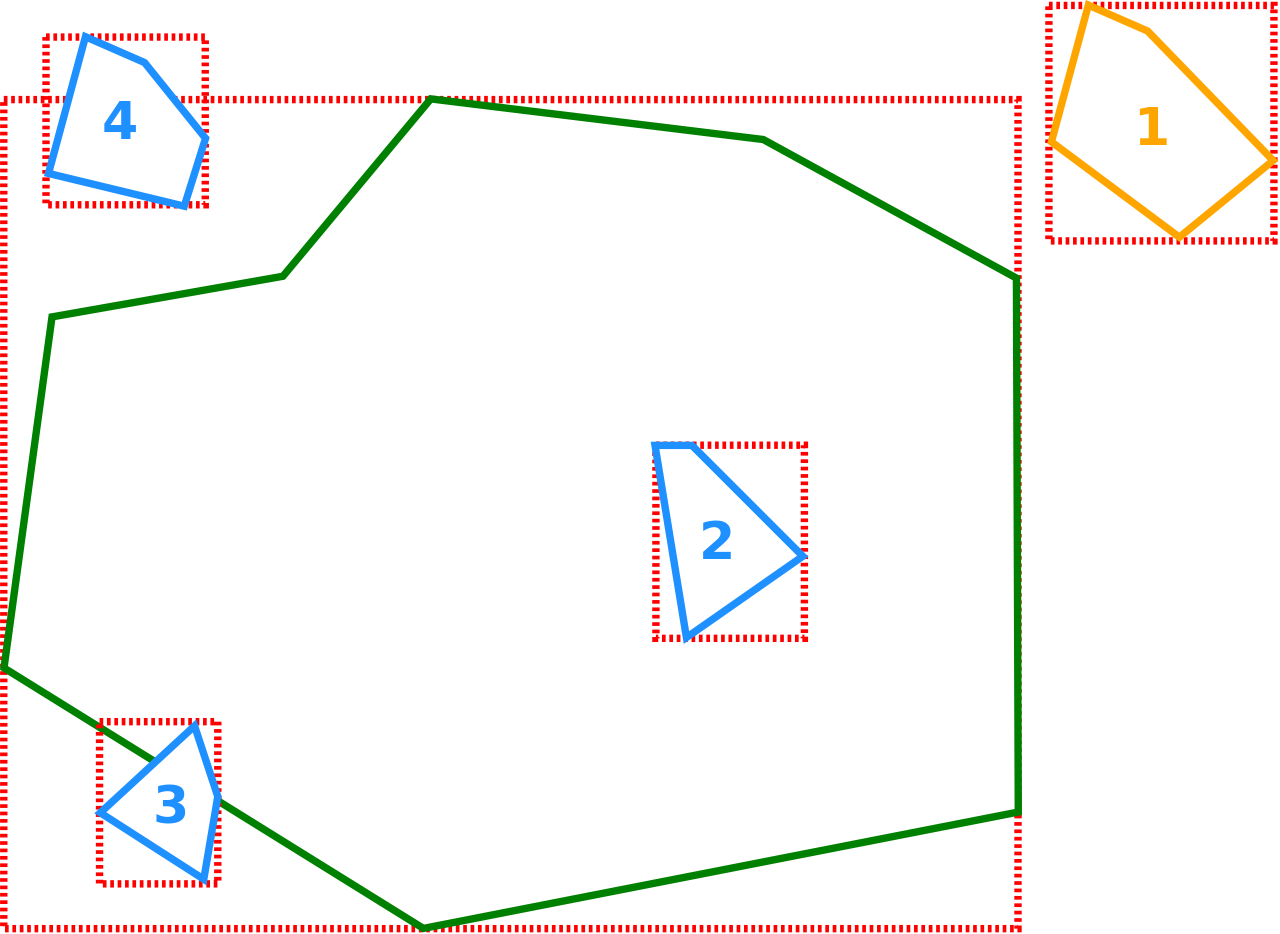
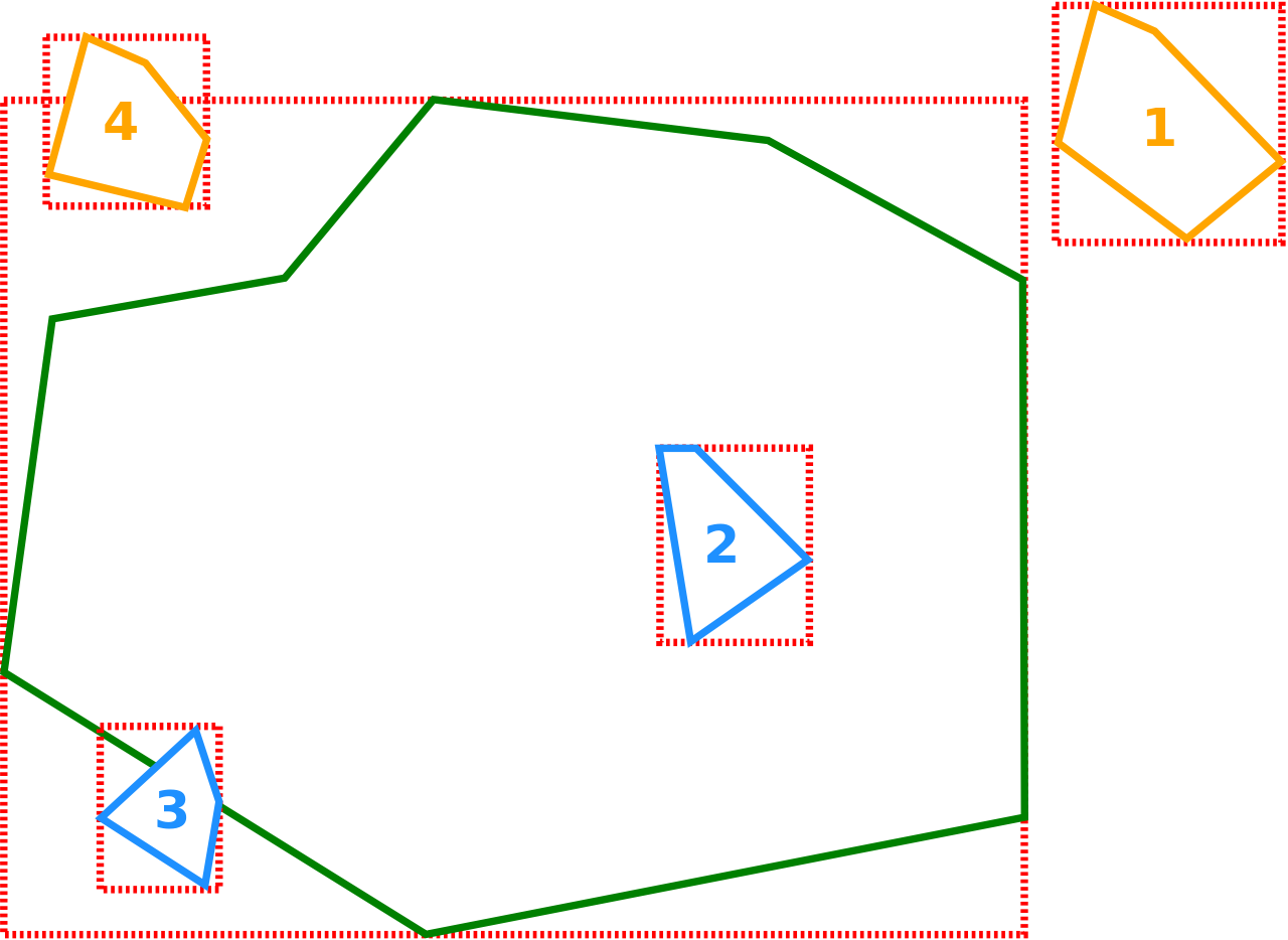
Spatial operators
BBox operators
This spatial operators operate on bounding boxes:
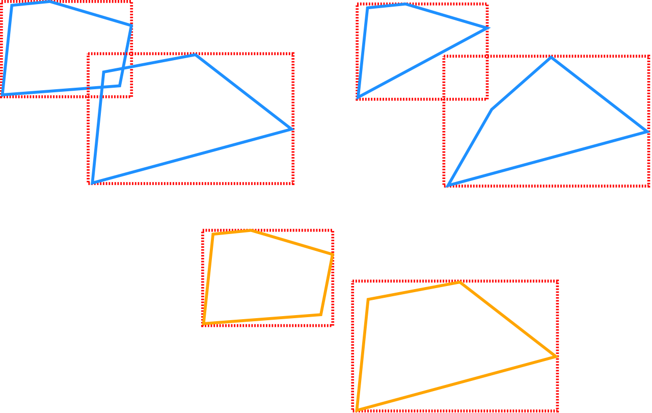
&&— Returns TRUE if A's 2D bounding box intersects B's 2D bounding box.@— Returns TRUE if A's bounding box is contained by B's.~=— Returns TRUE if A's bounding box is the same as B's.- ...
Full list: https://postgis.net/docs/reference.html#operators-bbox
select
st_geomfromtext('POLYGON((1 0, 2 1, 1 2, 0 1, 1 0))')
&&
st_geomfromtext('POLYGON((3 2, 4 3, 3 4, 2 3, 3 2))');

Task
Try different bbox operators: &<, &>, <<, ...
Now let's focus on OSM data (vineyards):
and apply && spatial operator on roads:
And display result in QGIS.
Tip
Take a look on query planner (explain select ... and explain analyze select ...). To improve performence create index on landuse.fclass.
Distance operators
<->— Returns the 2D distance between A and B.<#>— Returns the 2D distance between A and B bounding boxes.- ...
Full list: https://postgis.net/docs/reference.html#operators-distance
select
st_geomfromtext('POLYGON((1 0, 2 1, 1 2, 0 1, 1 0))')
<->
st_geomfromtext('POLYGON((3 2, 4 3, 3 4, 2 3, 3 2))');
Task
Compare with <#> distance operator.
Let's find the nearest library (current position: https://mapy.cz/s/coremubako):
with cp as
(select st_setsrid(st_point(14.3881100, 50.1041200), 4326)::geography as geom)
select name,p.geom::geography <-> cp.geom as dist from pois as p
cross join cp
where fclass = 'library'
order by dist
limit 5;
Note
Compare with st_distance().
Spatial filters
Spatial relationships have been explain in the previous lesson.
Examples above:
select st_intersects(
st_geomfromtext('POLYGON((1 0, 2 1, 1 2, 0 1, 1 0))'),
st_geomfromtext('POLYGON((3 2, 4 3, 3 4, 2 3, 3 2))'));
To get answer how spatial filtering is performed, examine query
planner by explain select ....
Note
Query planner gives also explanation why distinct is needed here.
Spatial filtering is performed in two steps:
(1) Select geometries using bbox operator (&&);
(2) Apply spatial relationship predicate only on subset of geometries from the step above.
Task
Try various spatial predicates (st_within(), st_contains(), st_touches()).
Example:
Let's take a closer look on spatial filter applied in lesson
9: find nearest cinema based on our
current location. This task may be elegantly (and more precisely -
buffer is approximated by a polygon - note that rings are represented
by rings/linestrings not curves) solved by st_dwithin().
with cinema as
(select st_transform(geom, 3035) as geom, name from pois where fclass = 'cinema'),
aoi as
(select st_transform(st_setsrid(st_point(14.3886592, 50.1042994), 4326), 3035) as geom)
select c.* from cinema as c
join aoi
on st_dwithin(c.geom, aoi.geom, 3000);
Task
Compare result with
with cinema as
(select st_transform(geom, 3035) as geom, name from pois where fclass = 'cinema'),
aoi as
(select st_buffer(st_transform(st_setsrid(st_point(14.3886592, 50.1042994), 4326), 3035), 3000) as geom)
select c.* from cinema as c
join aoi
on st_within(c.geom, aoi.geom);
and explain difference. Try to increase buffer precision, see PostGIS documentation.