1. Introduction into GIS, Open Geospatial Datasets
A brief introduction to Geographical Information Systems (GIS) and a quick overview of various open geospatial datasets.
Note
More in related course: Geographic Information Systems (155GISE)
Definitions
- GIS has multiple definitions depending on the context and
application (source: Wikipedia):
- General: GIS is a system designed to capture, store, manipulate, analyze, manage, and present spatial or geographic data.
- Technical: GIS is a framework that integrates hardware, software, data, and workflows to analyze and visualize spatial relationships, patterns, and trends.
- Academic: GIS is a multidisciplinary tool used for spatial analysis and decision-making, combining cartography, statistical analysis, and database management.
- Geospatial data refers to any data that is associated with a
specific location (typically on the Earth's surface). It includes
information about:
- physical objects,
- events, or
- phenomena that have a geographic or spatial component, typically represented using coordinates.
Examples of geospatial data:
- administrative boundaries
- rivers, lakes
- roads
- elevation model
- contours
- sattelite imagery
- GPS data
- weather data
- ...
Access policies:
- open data
- can be freely used, re-used and redistributed by anyone (source: Open Definition)
- Example of licenses: Creative Commons (CC BY 4.0, CC0), Open Data Commons (ODbL), etc.
- proprietary (closed) data
- owned by an individual or organization, protected by copyright
Open Geospatial Data - Overview
Example of global datasets:
- Natural Earth Data - cultural, physical data
- USGS Earth Explorer - Earth Observation (EO) data, land cover, digital elevation models
- Sentinel Satellite Data - EO data
- OpenStreetMap - high spatial resolution cultural vector data
- Esri Open Data Hub - various data
- NASA Socioeconomic Data and Applications Center - agriculture, climate and health data
- Open Topography - LiDAR
- UNEP Environmental Data Explorer - population, forests, emissions, disasters, etc.
- NASA Earth Observations - atmosphere, energy, land, life, ocean
- Terra Populus - land cover, land use, and climate
- ...
Situation in Europe overview
How to search for open data in Europe
EU-based catalogue https://data.europa.eu/en
- Example: NUTS1 data (keyword:
NUTS territorial unitspublisher:Eurostat)
National catalogues:
First experience with the data
What software use to open geospatial data
GIS desktop applications:
- Esri ArcGIS https://arcgis.com
- QGIS https://qgis.org (open source)
- GRASS GIS https://grass.osgeo.org (open source)
- ...
Quick info on QGIS:
- Open source (GNU General Public License)
- Nowadays very popular and widespread in academia, commercial companies and governmental agencies
- A lot of plugins
- Available at https://plugins.qgis.org/
Quick info on Esri ArcGIS:
- Proprietary
- Most famous and widely used comprehensive GIS solution
Data manipulations
Data queries in QGIS:
- Attribute-based (QGIS documentation)
- Spatial (QGIS documentation)
Workflow example in QGIS:
-
Dissolve NUTS region by country code
Vector > Geoprocessing Tools > Dissolve
-
Query NUTS layer by country code
Select by Expression
-
Query NUTS layer by spatial relationship
Vector > Research Tools > Select by Location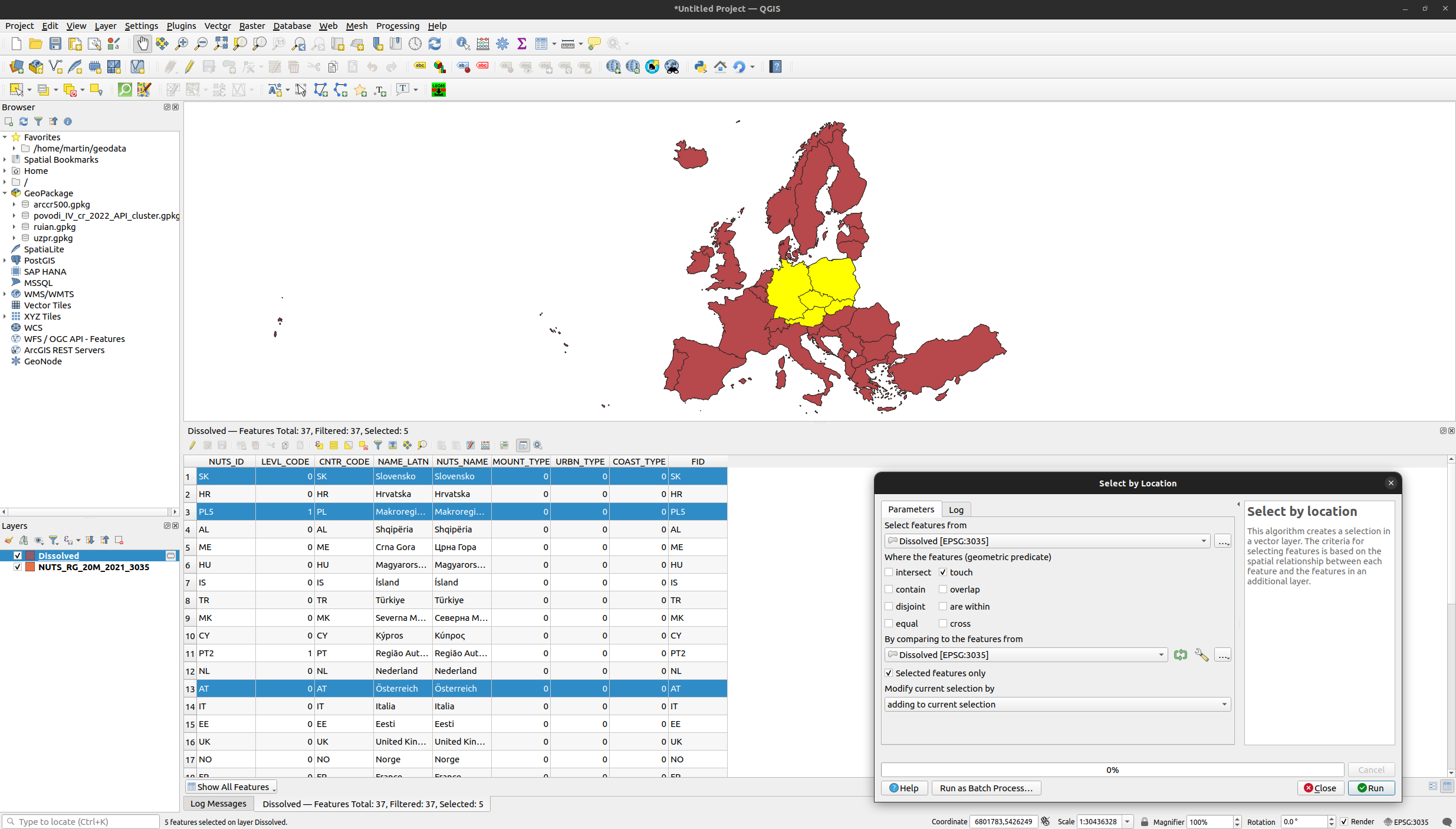
Workflow example in Esri ArcGIS Pro:
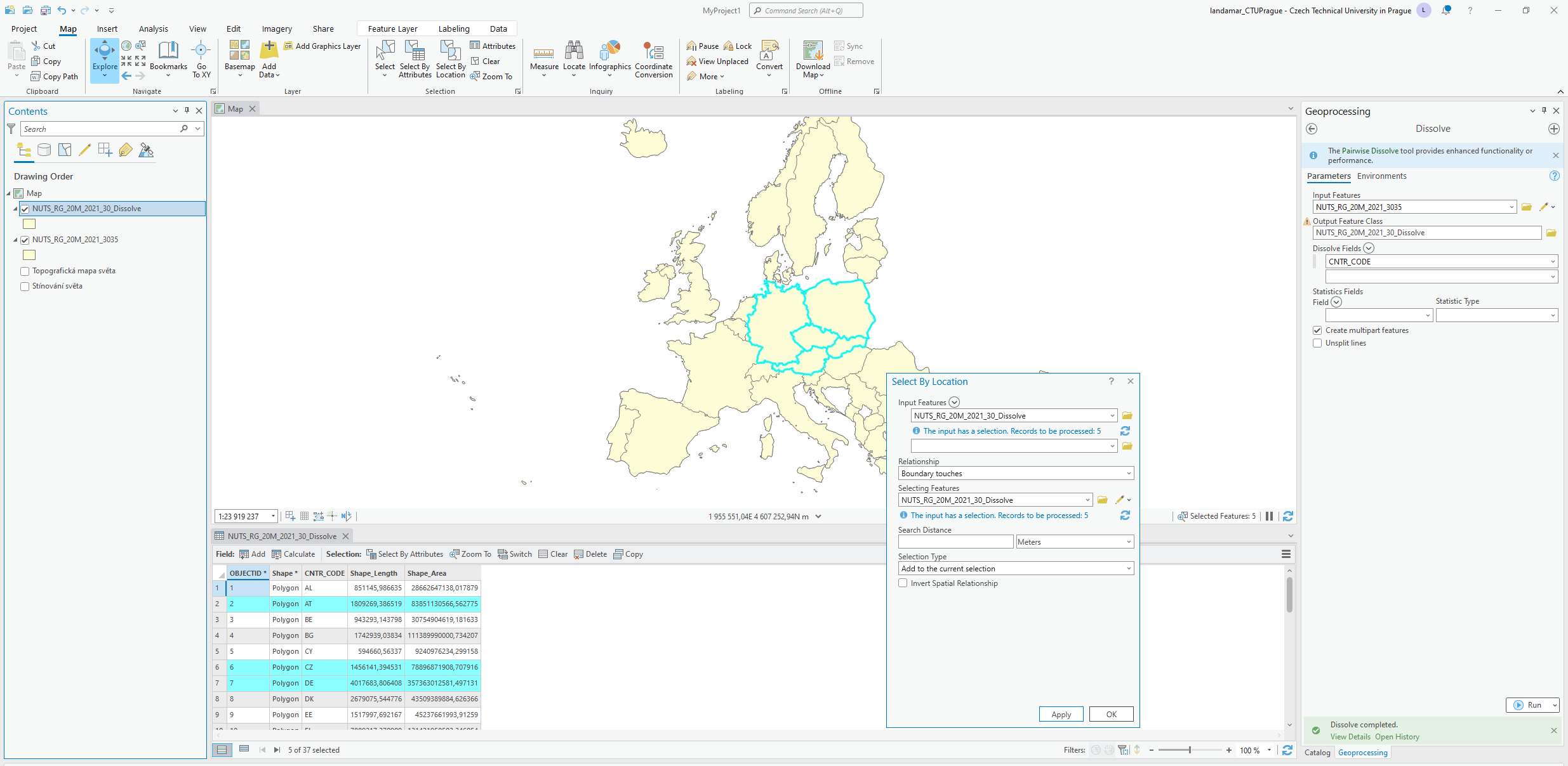
Task
Compute in ArcGIS Pro all tasks performed in QGIS.
Data examples
OpenStreetMap
General info:
- https://www.openstreetmap.org
- Vector
- Community-based
- Global scale
- Founded in 2004 in the UK
- Getting global in 2006
- OpenStreetMap foundation founded
- Data primitives
- Nodes
- Ways
- Relations
- Pros
- Community-based
- Open
- More than 100 GBs
- Global scale
- Very detailed information
- Community is independent to the project
- Cons
- Community-based
- Non-homogenous cover
- No quality consistence
- Open for contribution - iD Editor
Associated projects:
- HOTOSM
- https://www.hotosm.org/
- Humanitarian action and community development through open mapping
- mapy.cz
- https://mapy.cz/
- OSM serve as base data for foreign countries
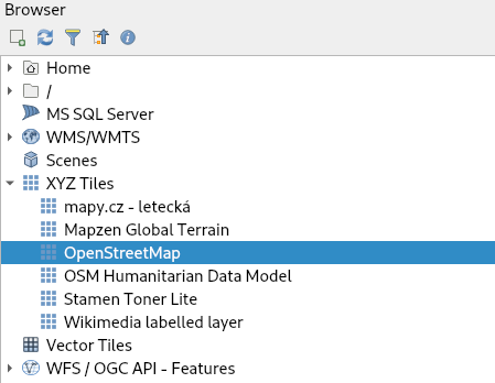
Data download:
- Simple export
- Overpass turbo
- https://overpass-turbo.eu/
- Runs Overpass API queries
- QGIS plugin - OSMDownloader
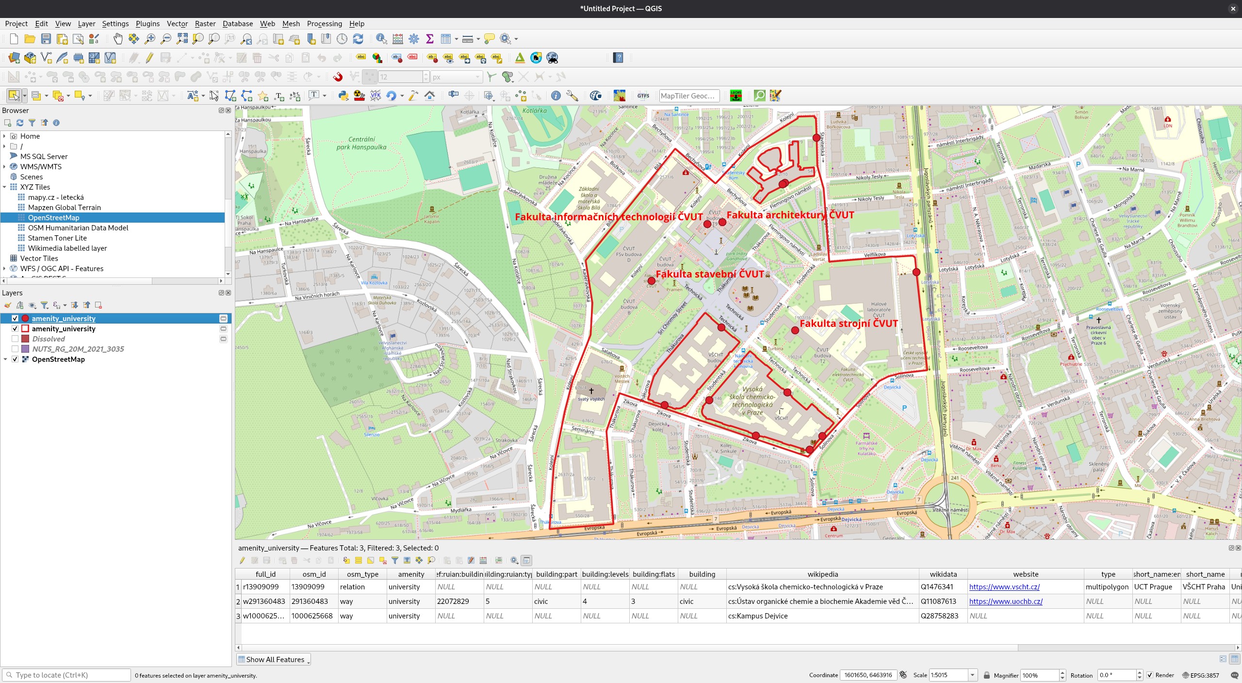
Workflow example in QGIS:
First, let's add OSM as a base map:
Task
Change map window coordinate system (CRS) to EPSG:3857 and compare map distorsions with the original CRS.
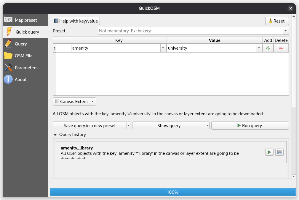
Zoom to your area of interest and download vector-based OSM data using
QuickOSM plugin.
Note
Install plugin by accessing Plugins > Manage and Install Plugins.
Download vector-based features of your interest (see OSM documentation):
Digital Elevation Model
International programmes:
- Copernicus DEM
- Available through Copernicus Data Ecosystem
- Raster
- Global (30, 90m) and European (10m)

- SRTM
- Available at https://srtm.csi.cgiar.org/srtmdata/
- Shuttle radar topography mission
- Near-global scale
- Measured using SAR
- Spatial resolution 30m
Simple processing examples in QGIS:
- Compute slope
Raster > Analysis > Slope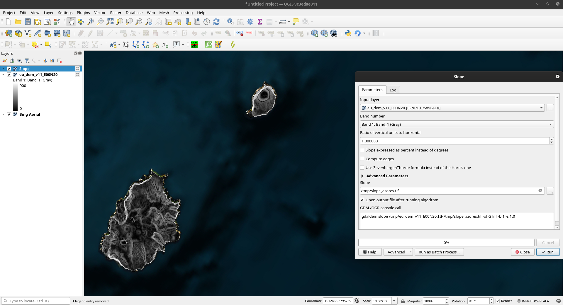
- Compute aspect
Raster > Analysis > Aspect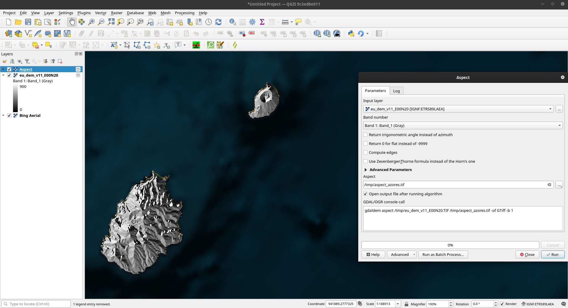
- Compute hillshade
Raster > Analysis > Hillshade
Task
Compute in ArcGIS Pro all tasks performed in QGIS.
Earth Observation data
General info:
- Data about the physical, chemical, and biological systems
- Natural as well as manmade environment
- Grid-structured data with spatial, additionaly also temporal information
- Sources
- Remote sensing
- Measurements
- Examples
- Photos
- Radar images
- Sonar images
- Measurements
- Included information
- Spectral information from satellites
- Thermometer measurements
- Altimeter measurements
- Wind gauge measurements
- Buoy measurements
Examples of raster satellite data sources:
- Open data
- Global
- Sentinel
- https://sentinel.esa.int/web/sentinel/missions
- Sentinel-1: Land and ocean monitoring with radar imaging
- Sentinel-2: Land monitoring
- Sentinel-3: Marine observation
- Sentinel-4: Air quality monitoring (to be launched in 2024)
- Sentinel-5: Air quality monitoring
- Sentinel-5P: Sentinel-5 precursor
- Sentinel-6: Sea-surface altimetry
- Landsat
- https://earth.esa.int/eogateway/missions/landsat
- Landsat-1 to 5: Resolution of 60 to 80 m
- Landsat-1: 1972 -- 1978
- Landsat-2: 1975 -- 1982
- Landsat-3: 1978 -- 1983
- Landsat-4: 1982 -- 1993
- Landsat-5: 1984 -- 1999 (limited work acquisitions until 2013)
- Landsat-7: 1999
- Still operational
- Land and coastal areas, shallow waters
- 8 bands
- Resolution of 15 to 60 m
- Landsat-8: 2013
- Still operational
- Land and coastal areas, shallow waters
- 11 bands (9 spectral bands, 2 thermal bands)
- Spectral bands resolution 15 to 30 m, thermal bands 100 m
- ...
- Sentinel
- Areas of interest
- VENµS
- Data and areas of interest available at https://www.theia-land.fr/en/product/venus/
- Resolution of 5 to 10 m
- ...
- VENµS
- Global
- Proprietary data
- Pleiades
- https://earth.esa.int/eogateway/missions/pleiades
- Owned by Airbus
- 5 bands
- Resolution of 0.5 to 2 m
- Data availability: 2011 onwards
- SPOT 6/7
- https://earth.esa.int/eogateway/missions/spot
- Owned by Airbus
- 5 bands
- Resolution of 1.5 to 6 m
- Data availability: 2012 onwards
- WorldView
- https://earth.esa.int/eogateway/missions/worldview
- Owned by Maxar
- 5 bands
- Resolution of 0.3 to 2 m
- Data availability: 2009 onwards
- Pleiades
Sentinel-2 data:
- Global coverage
- 13 bands
- Spatial resolution of 10 to 60 m
- Data availability: 2015 onwards
- Revisit time of 2 days
- Land and coastal areas, shallow waters
- Download examples
- Web-based
- Copernicus Browser: https://browser.dataspace.copernicus.eu/
- Sentinel Hub: https://apps.sentinel-hub.com/eo-browser/
- Google Earth Engine: https://earthengine.google.com/
- Copernicus Browser: https://browser.dataspace.copernicus.eu/
- GIS software plugins
- QGIS SentinelHub plugin
- https://plugins.qgis.org/plugins/SentinelHub/
- See documentation
- Uses Sentinel Hub or Copernicus Data Ecosystem services in background
- QGIS Sentinel-2 Download plugin
- https://plugins.qgis.org/plugins/sentinel2_download/
- Uses Google Earth Engine in background
- QGIS SentinelHub plugin
- Web-based
Task
Try to fetch Sentinel-2 data using Copernicus Browser and/or QGIS SentinelHub.