Seznam souborů
Tato speciální stránka zobrazuje všechny načtené soubory.
| Datum | Název | Náhled | Velikost (bajtů) | Uživatel | Popis | Verze |
|---|---|---|---|---|---|---|
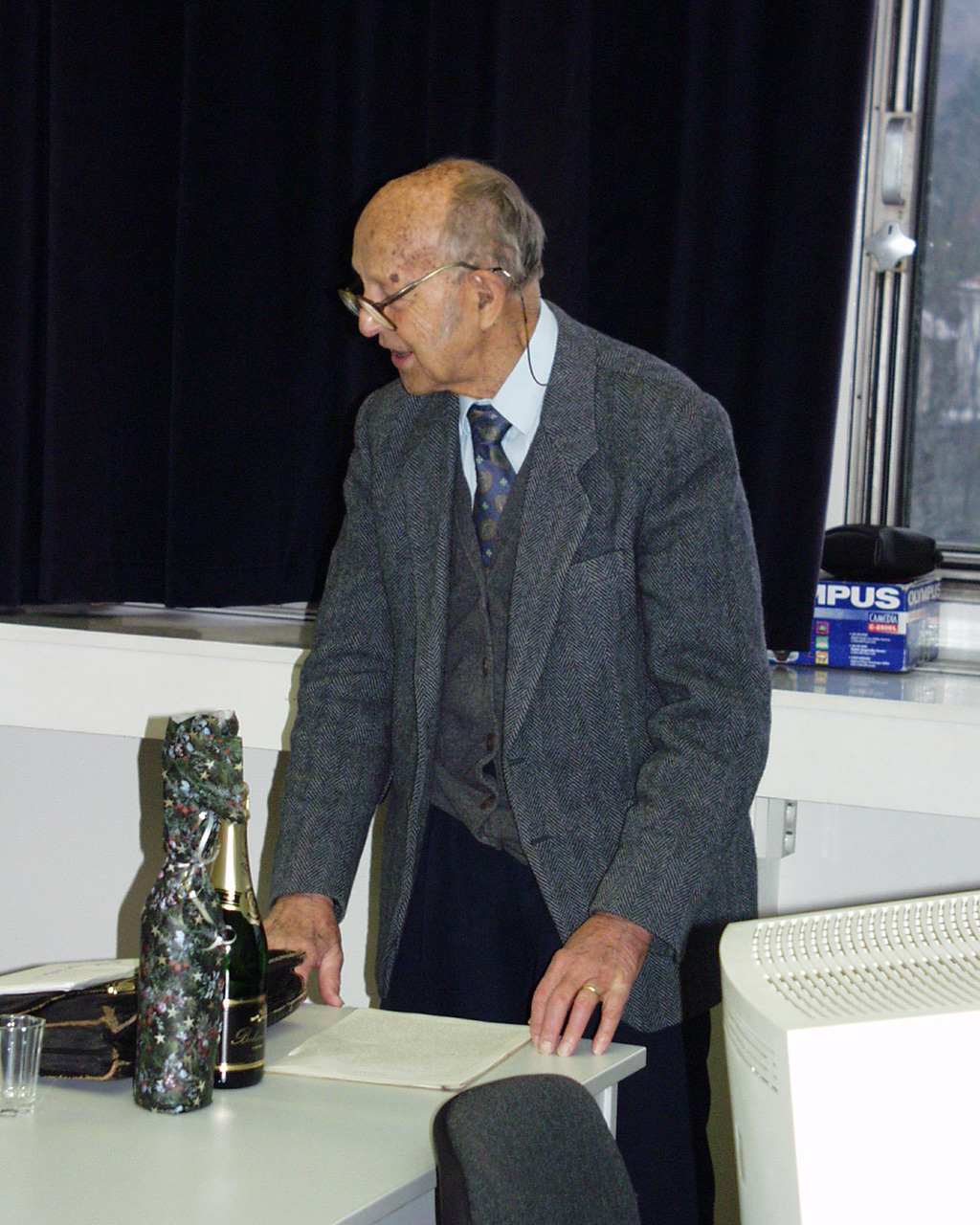
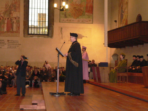
| 5. 1. 2011, 10:21 | 2001-ondrej-jerabek.jpg (soubor) |  |
405 KB | Cepek | Ondřej Jeřábek, Seminář "Aktuální problémy fotogrammetrie a DPZ" pořádaném při výročí 85 let Ondřeje Jeřábka, Stavební fakulta ČVUT v Praze, 11. prosince 2001 | 1 |
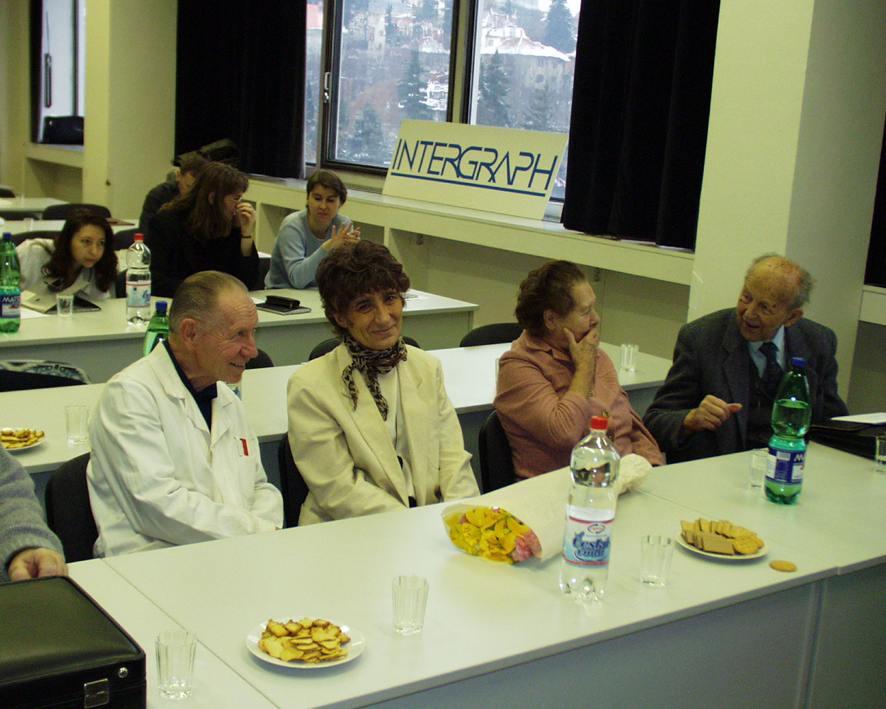
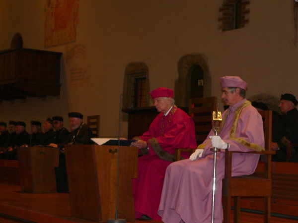
| 5. 1. 2011, 10:37 | 2001-ruzek-juraskova-jerabkovi.jpg (soubor) |  |
414 KB | Cepek | Doc. Růžek, Ing. Jurášková a manželé Jeřábkovi na semináři "Aktuální problémy fotogrammetrie a DPZ" pořádaném při výročí 85 let Ondřeje Jeřábka, Stavební fakulta ČVUT v Praze, 11. prosince 2001 | 1 |
| 31. 5. 2022, 06:38 | 22SZZ rozpis Bc IG.pdf (soubor) | 33 KB | Cajthaml | 1 | ||
| 27. 10. 2020, 08:35 | 3D 4.JPG (soubor) |  |
206 KB | Cajthaml | 1 | |
| 18. 10. 2010, 14:41 | Amuller.jpg (soubor) |  |
16 KB | Muller | Foto Arnost Muller. | 1 |
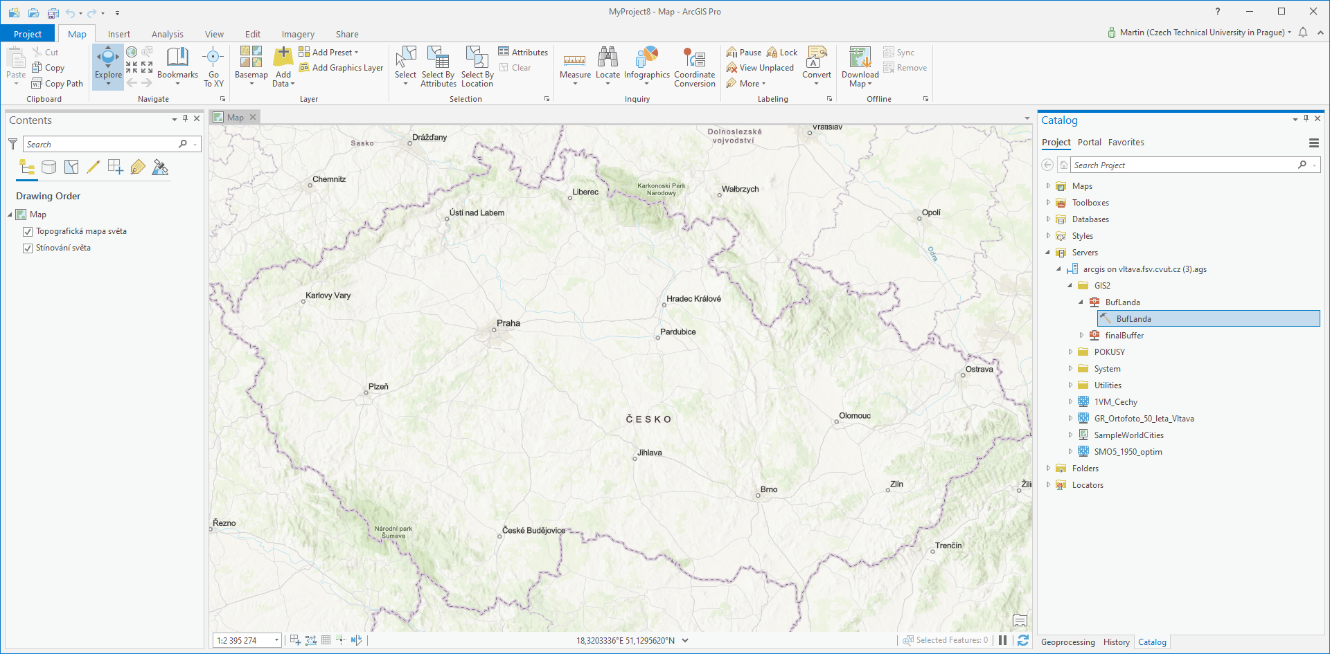
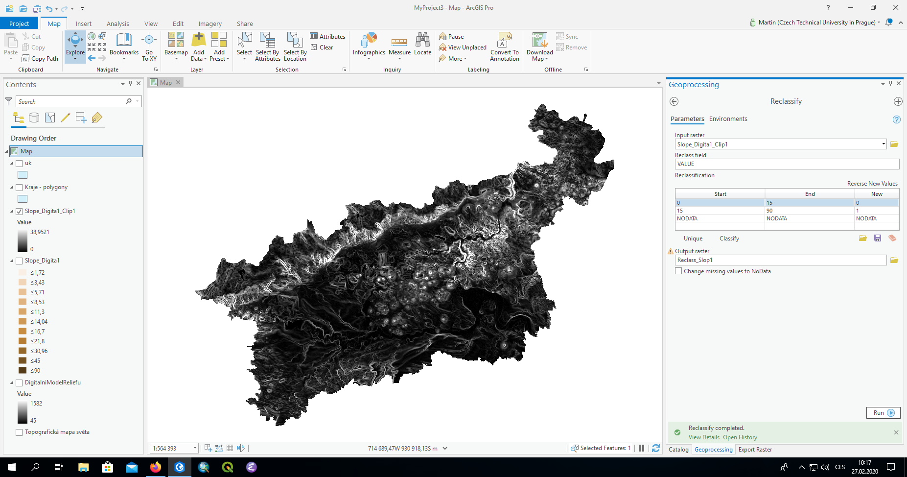
| 28. 4. 2021, 17:13 | Arcgis-geoprocessing-service.png (soubor) |  |
1,17 MB | Landa | Volání geoprocessingové služby z prostředí ArcGIS Pro | 1 |
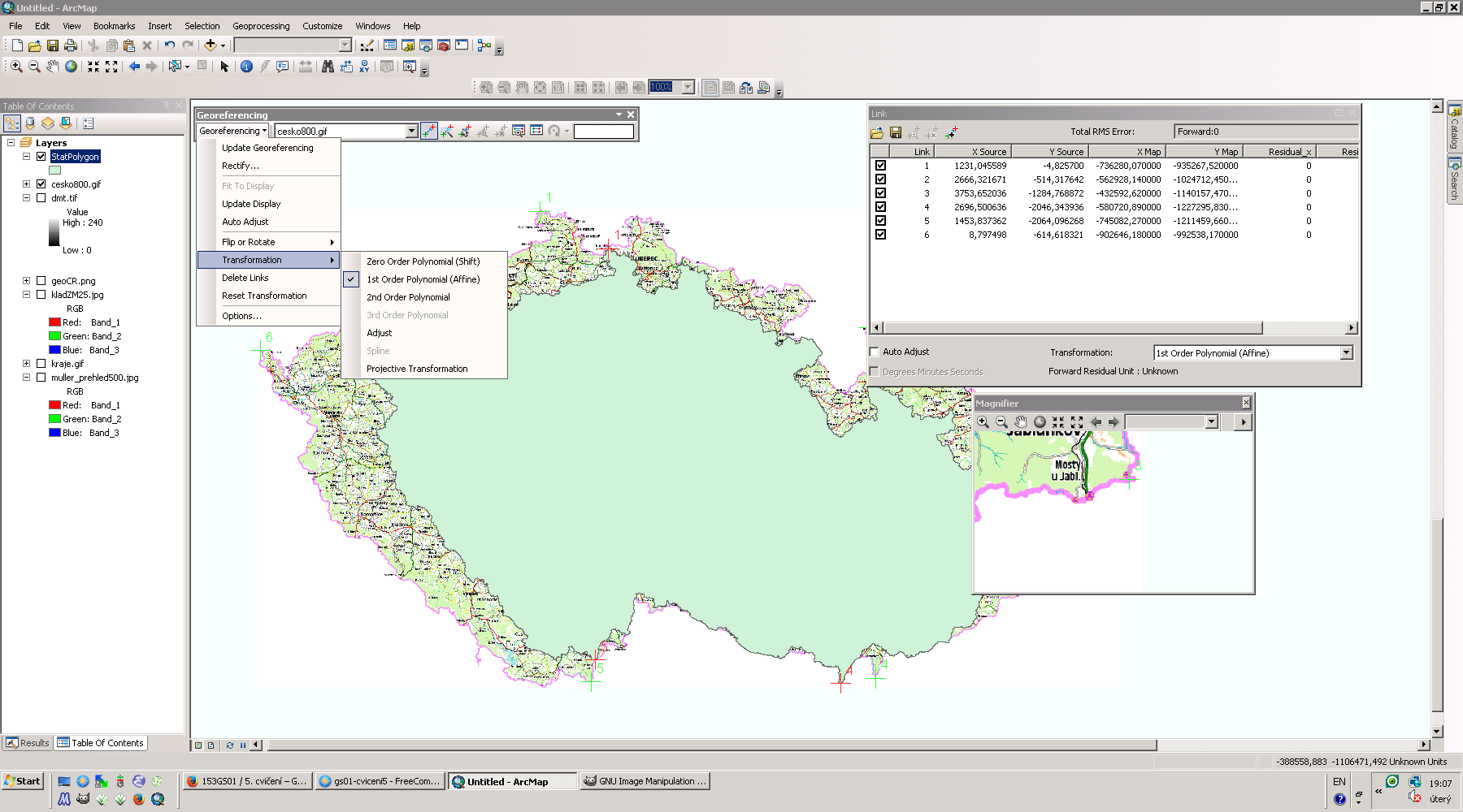
| 5. 11. 2013, 18:09 | Arcgis-georef.png (soubor) |  |
230 KB | Landa | Souřadnicové připojení rastru cesko800.gif v systému ArcGIS {{GIS}} | 1 |
| 30. 10. 2013, 13:01 | Arcgis-gis1-4-uloha-3.png (soubor) |  |
111 KB | Landa | Porovnání prostorového vztahu "within" a "completely within" {{GIS}} | 1 |
| 27. 2. 2020, 09:19 | Arcgis-gis2-cv2.png (soubor) |  |
512 KB | Landa | 2 | |
| 4. 3. 2014, 11:37 | Arcgis-gis2-cv3.png (soubor) |  |
221 KB | Landa | Řešení první úlohy třetího cvičení GIS 2 v ArcGIS {{ArcGIS}} | 1 |
| 11. 3. 2014, 11:23 | Arcgis-gis2-cv4.png (soubor) |  |
100 KB | Landa | Řešení první úlohy čtvrtého cvičení GIS 2 v ArcGIS {{ArcGIS}} | 1 |
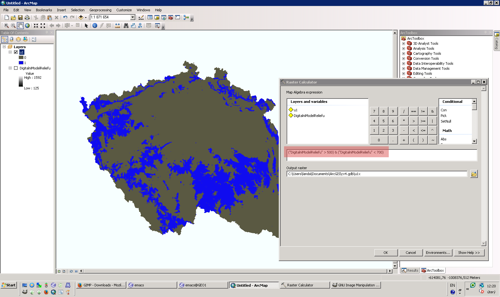
| 22. 3. 2014, 13:09 | Arcgis-gis2-cv5.png (soubor) |  |
179 KB | Landa | Řešení první úlohy čtvrtého cvičení GIS 2 v ArcGIS {{ArcGIS}} | 1 |
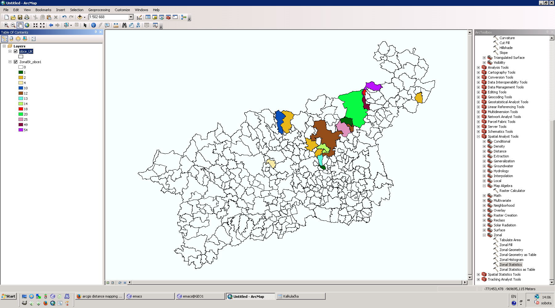
| 31. 3. 2014, 14:44 | Arcgis-gis2-cv6.png (soubor) |  |
196 KB | Landa | Řešení první a druhé úlohy pátého cvičení GIS 2 v ArcGIS {{ArcGIS}} | 1 |
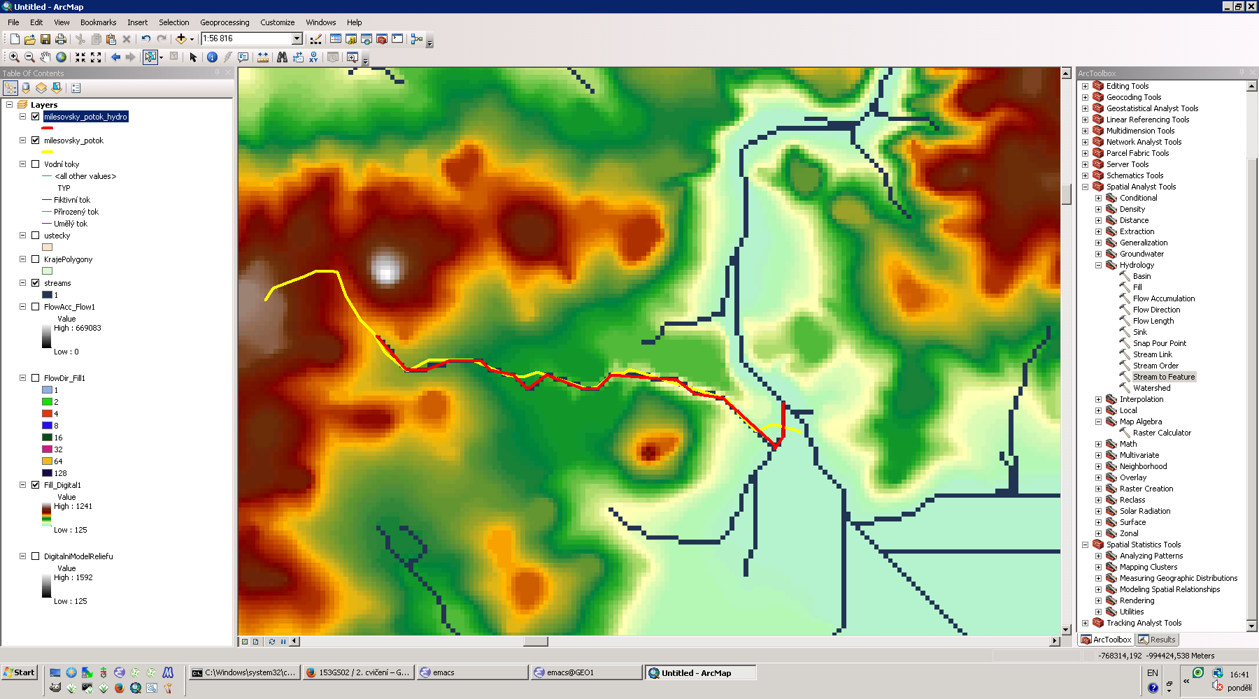
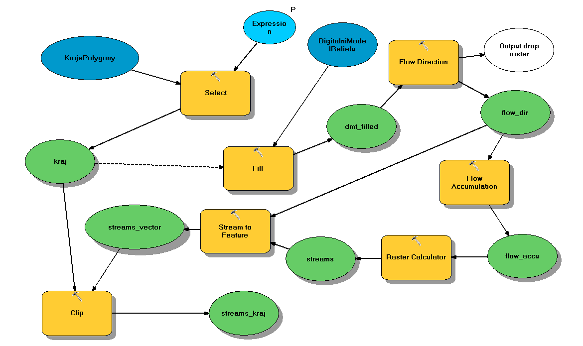
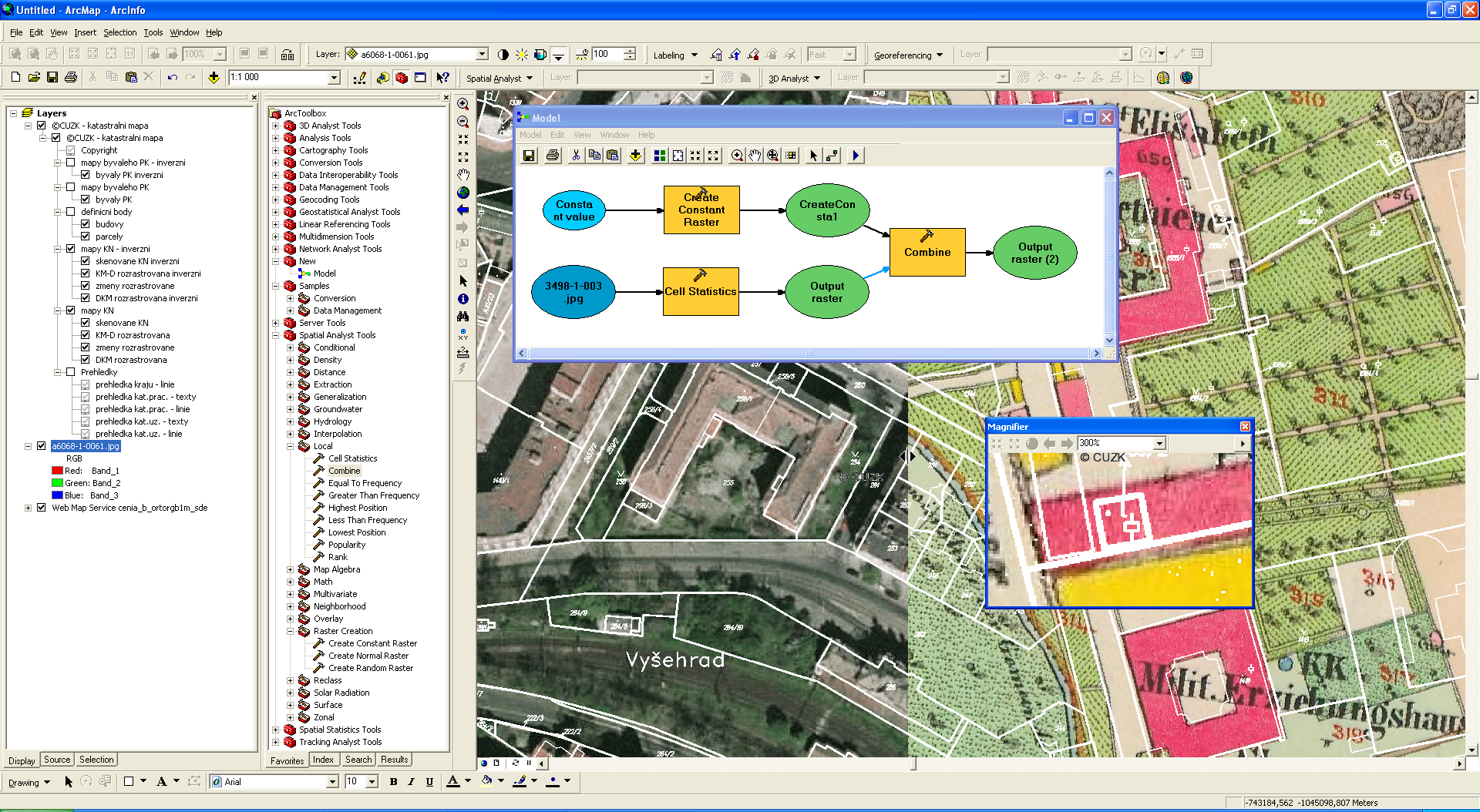
| 20. 5. 2014, 14:11 | Arcgis-gis2-cv9-1.png (soubor) |  |
331 KB | Landa | Spuštění úlohy modeleru v ArcGIS {{ArcGIS}} | 1 |
| 20. 5. 2014, 14:00 | Arcgis-gis2-cv9.png (soubor) |  |
24 KB | Landa | Řešení úlohy devátého cvičení GIS 2 v ArcGIS {{ArcGIS}} | 1 |
| 19. 11. 2013, 10:33 | Arcgis-gs01-6-1.png (soubor) |  |
75 KB | Landa | Řešení první úlohy v systému ArcGIS {{GIS}} | 1 |
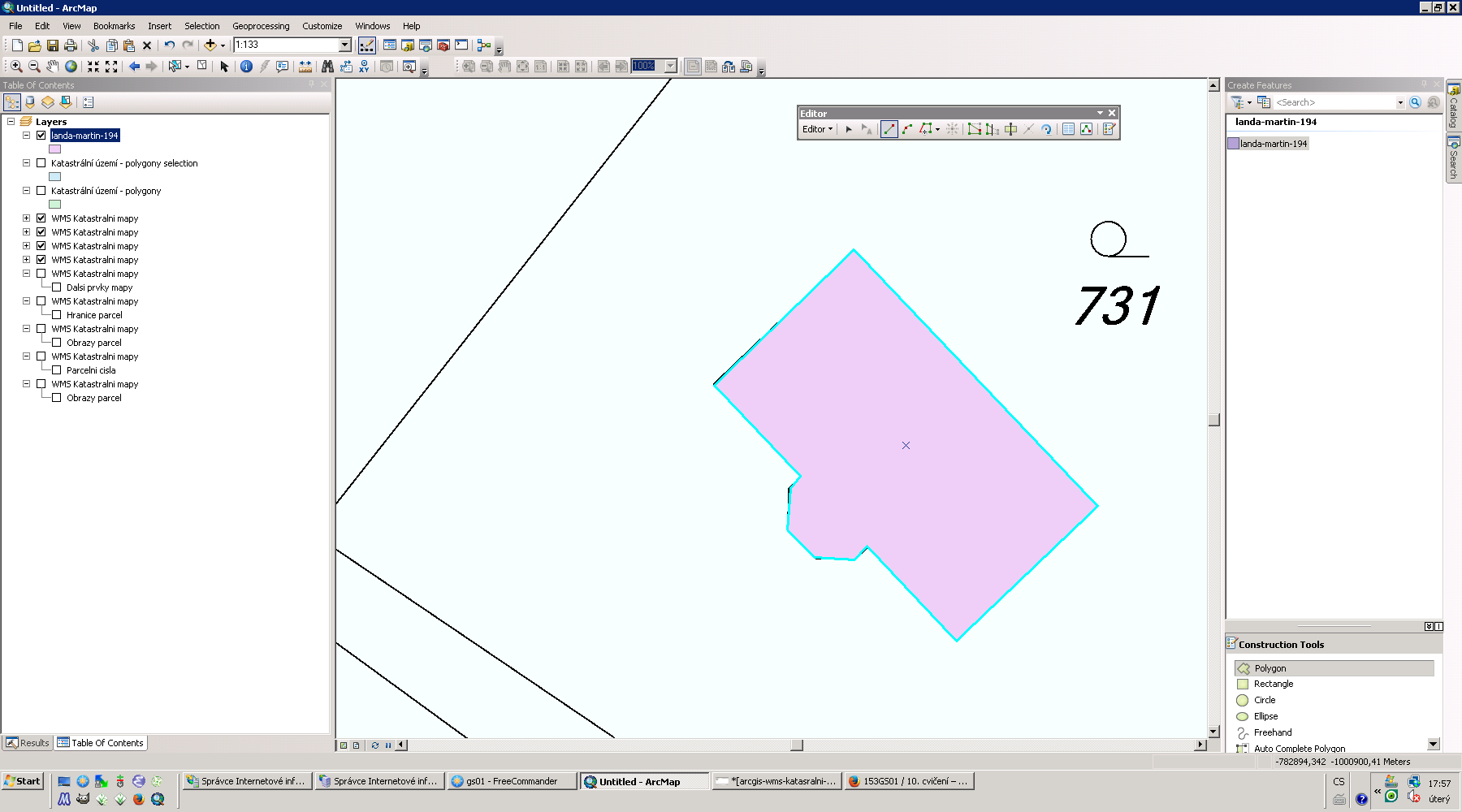
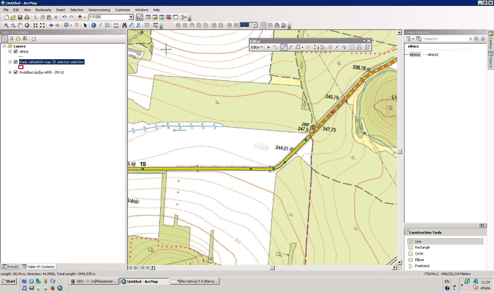
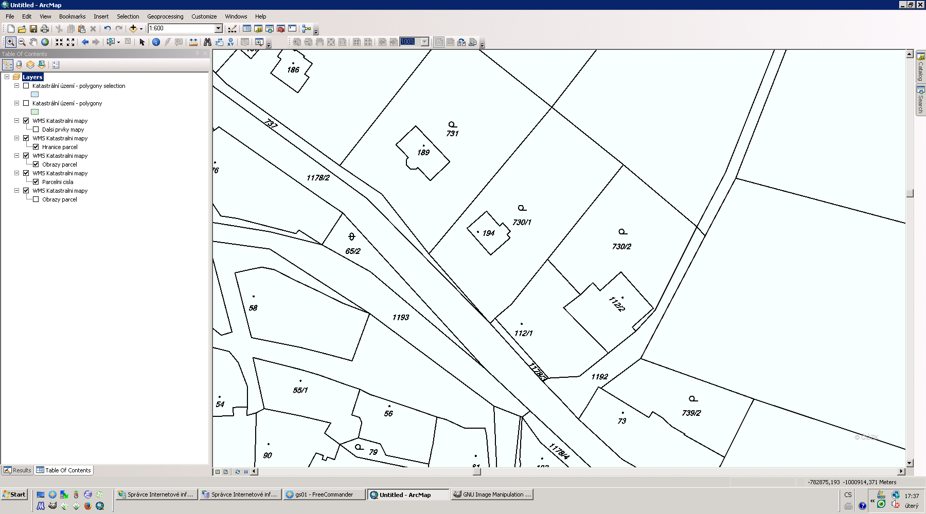
| 10. 12. 2013, 17:00 | Arcgis-parcela-dig.png (soubor) |  |
95 KB | Landa | Příklad digitalizace zvolené parcely na základě WMS | 1 |
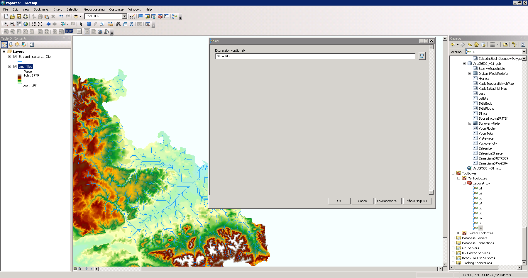
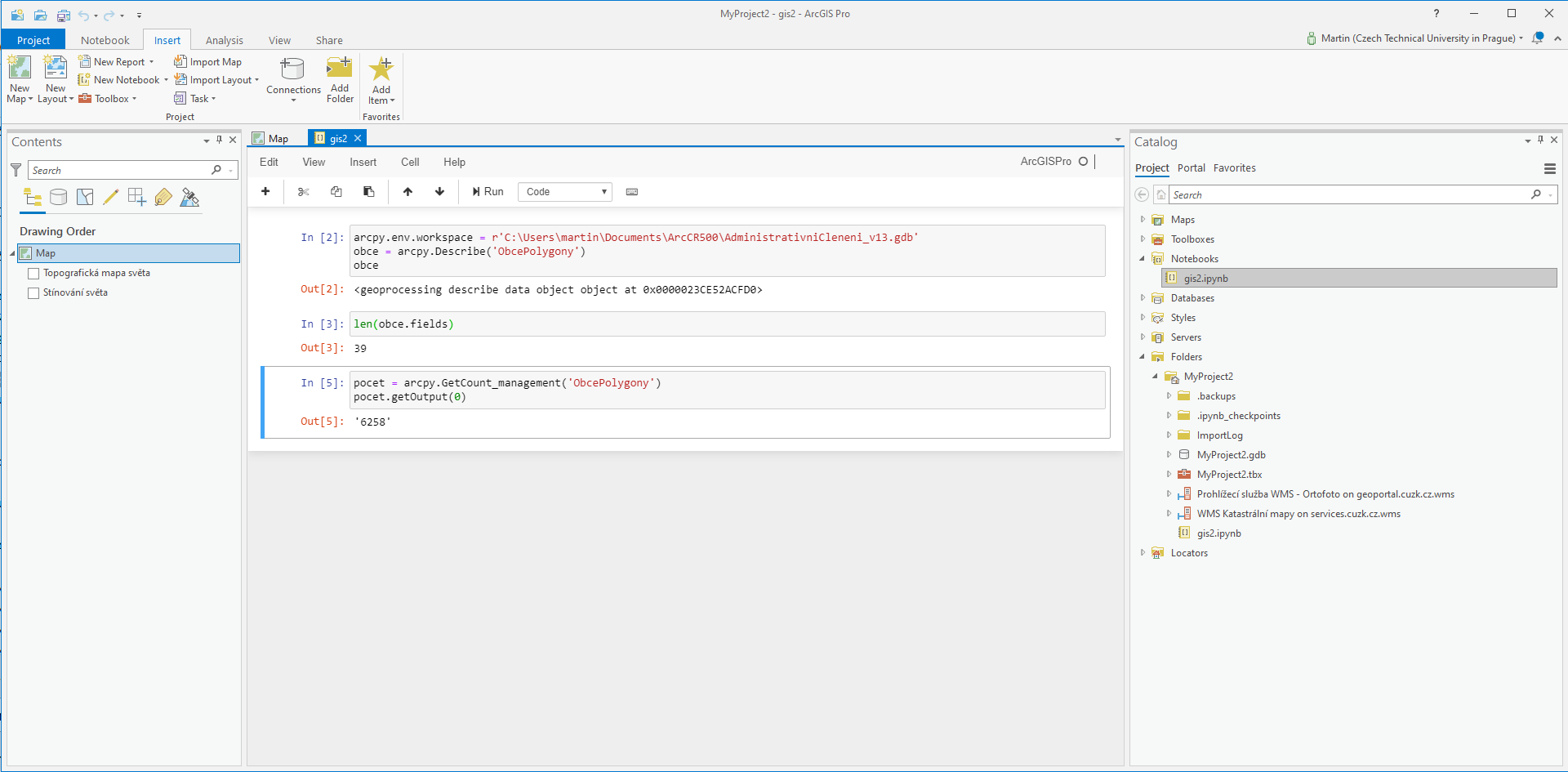
| 13. 4. 2021, 19:04 | Arcgis-pro-notebook.png (soubor) |  |
106 KB | Landa | 1 | |
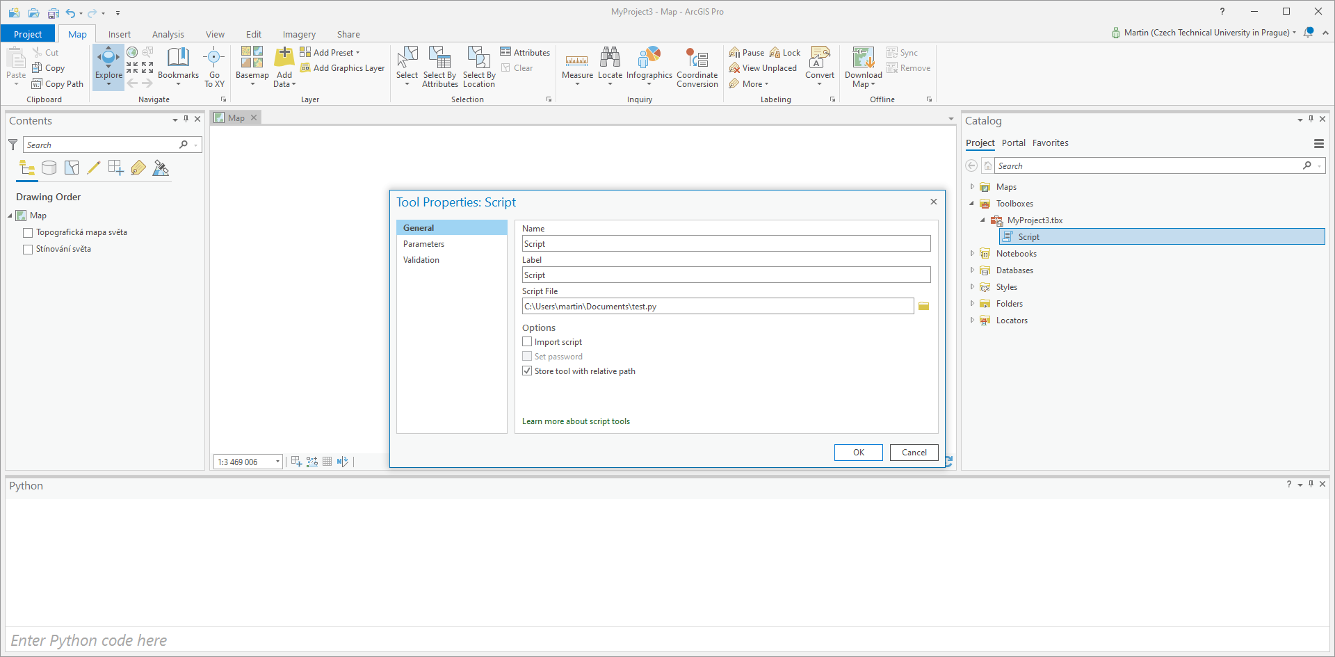
| 21. 4. 2021, 08:13 | Arcgis-pro-script.png (soubor) |  |
97 KB | Landa | Registrace skriptu v prostředí ArcGIS Pro | 1 |
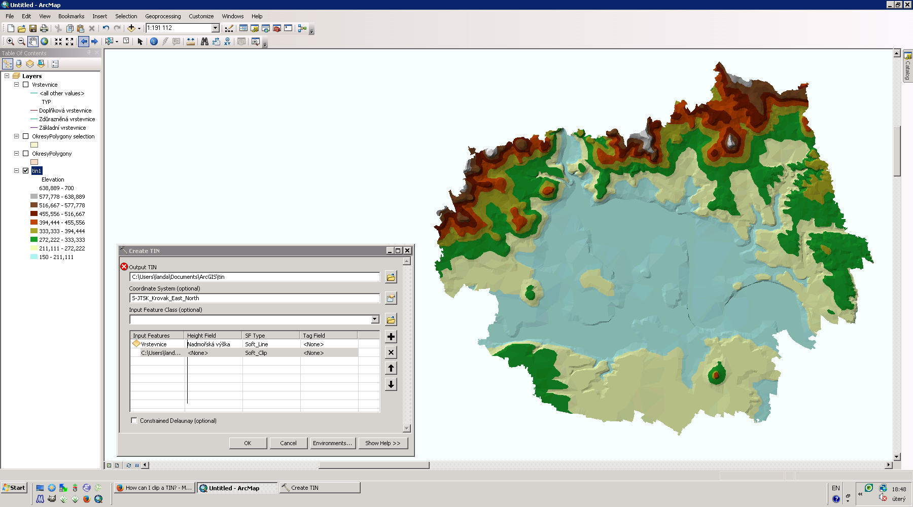
| 18. 2. 2014, 17:50 | Arcgis-tin-ltm.png (soubor) |  |
257 KB | Landa | TIN pro okres Litoměřice {{ArcGIS}} | 1 |
| 27. 11. 2013, 10:27 | Arcgis-vektorizace-gs01-07.png (soubor) |  |
319 KB | Landa | Řešení první úlohy v systému ArcGIS {{GIS}} | 1 |
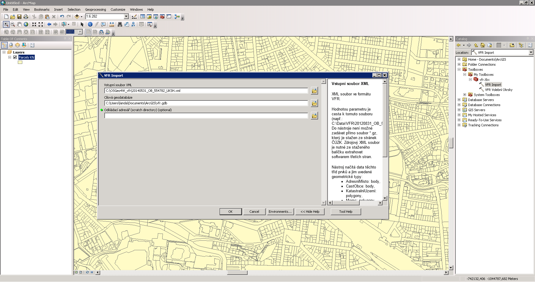
| 2. 12. 2014, 21:44 | Arcgis-vfr.png (soubor) |  |
146 KB | Landa | Import dat VFR do prostředí Esri ArcGIS {{ArcGIS}} | 1 |
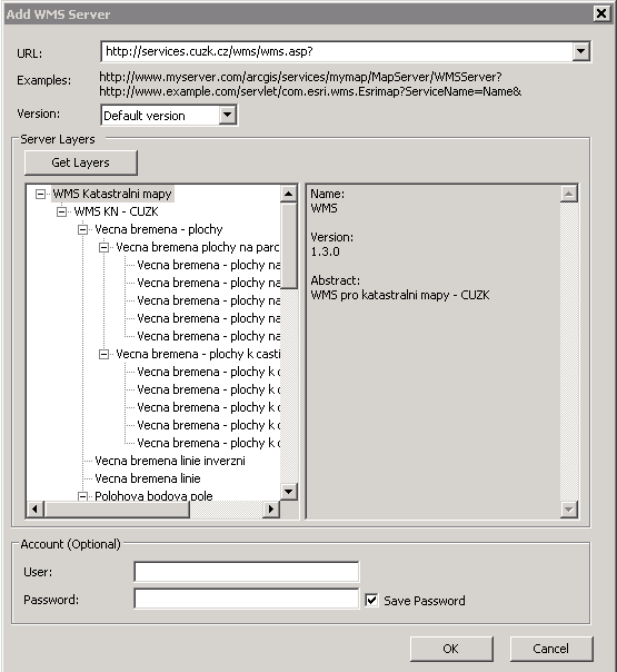
| 10. 12. 2013, 16:48 | Arcgis-wms-cuzk-0.png (soubor) |  |
11 KB | Landa | Přidání WMS služby v ArcGISu | 1 |
| 10. 12. 2013, 16:49 | Arcgis-wms-cuzk-1.png (soubor) |  |
8 KB | Landa | Volba vrstev ze zvoleného WMS serveru, které budou zobrazeny | 1 |
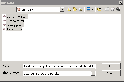
| 10. 12. 2013, 16:40 | Arcgis-wms-cuzk.png (soubor) |  |
97 KB | Landa | Příklad připojení katastrální mapy jako WMS služby | 1 |
| 4. 10. 2016, 20:35 | Arcgis.png (soubor) |  |
764 KB | Landa | Prostředí Esri ArcGIS | 1 |
| 21. 4. 2010, 06:12 | Arcgis3.png (soubor) |  |
1,28 MB | Cepek | 1 | |
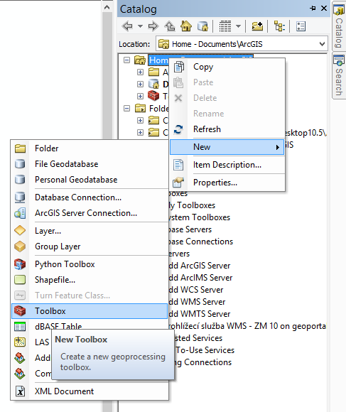
| 20. 11. 2018, 14:08 | Arcgis toolbox.png (soubor) |  |
46 KB | Landa | 1 | |
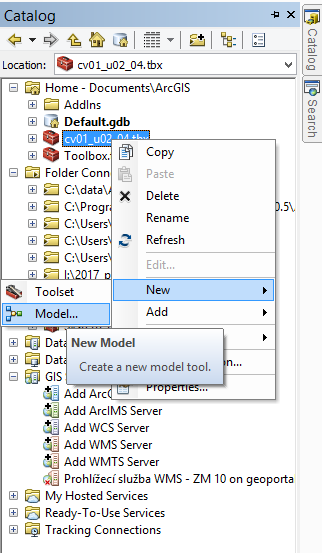
| 20. 11. 2018, 14:09 | Arcgis toolbox model.png (soubor) |  |
38 KB | Landa | 1 | |
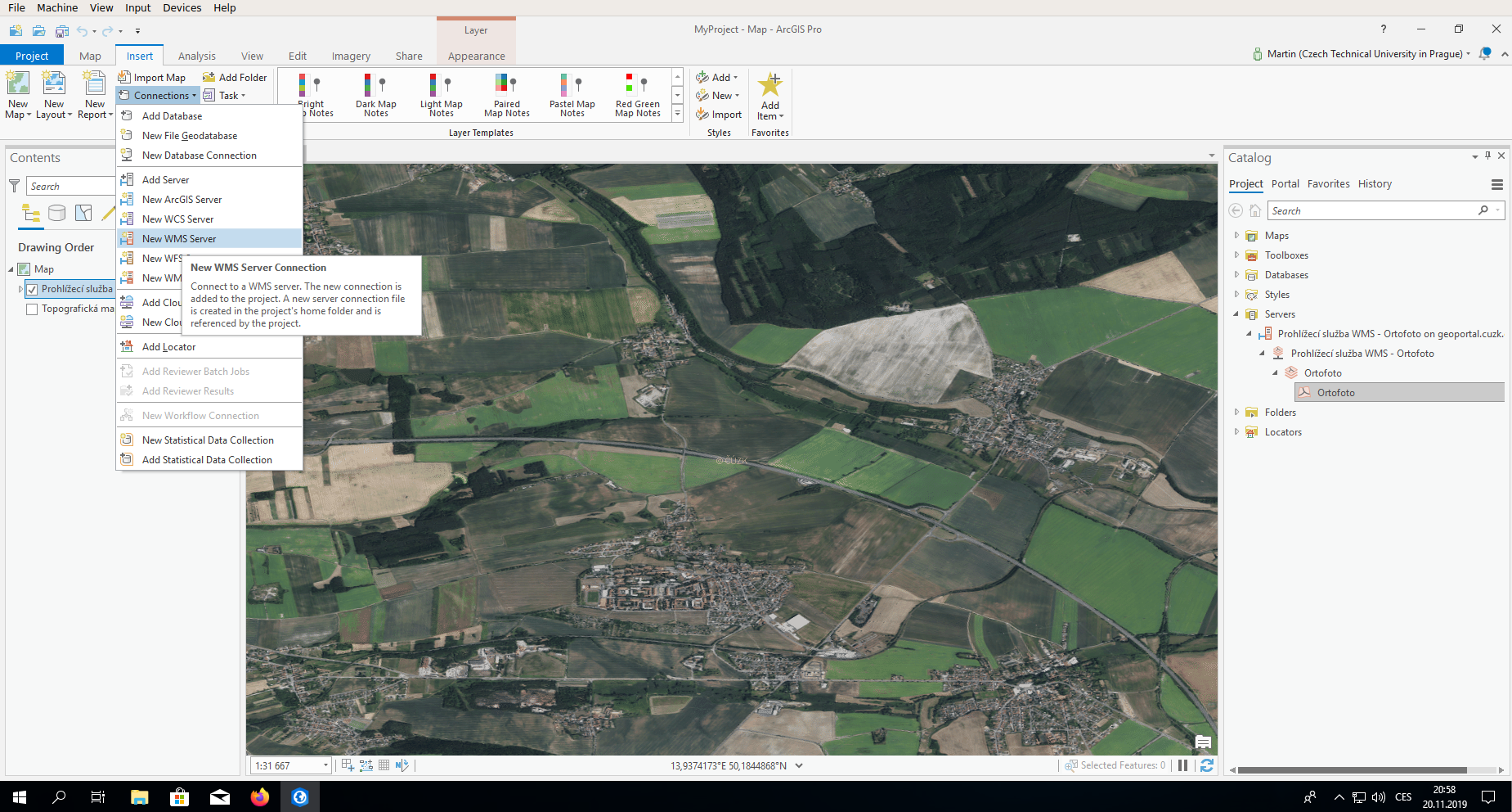
| 20. 11. 2019, 20:03 | Arcgispro-wms.png (soubor) |  |
1,38 MB | Landa | 1 | |
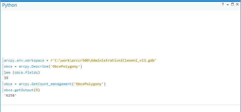
| 7. 5. 2020, 10:57 | Arcpy.png (soubor) |  |
15 KB | Landa | 2 | |
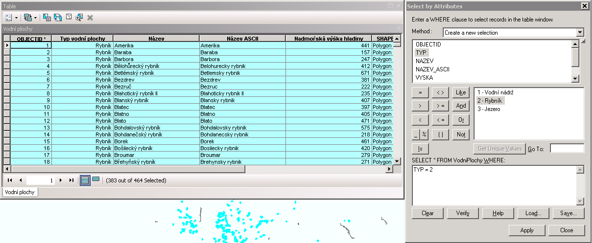
| 30. 9. 2013, 16:06 | Argis-atributy-rybniky.png (soubor) |  |
34 KB | Landa | Řešení první úlohy v ArcGIS {{GIS}} | 1 |
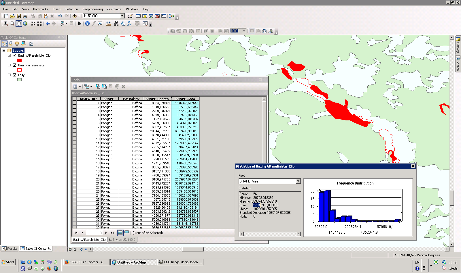
| 30. 10. 2013, 09:32 | Argis-clip.png (soubor) |  |
123 KB | Landa | Řešení první úlohy v ArcGIS {{GIS}} | 1 |
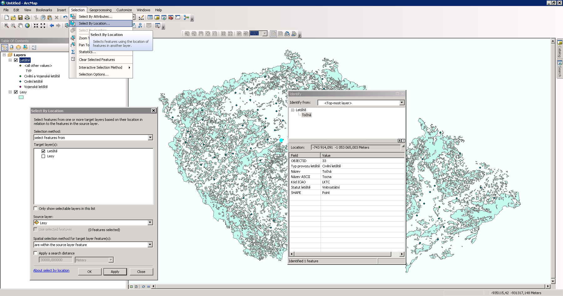
| 8. 10. 2013, 08:26 | Argis-letiste-les.png (soubor) |  |
156 KB | Landa | Řešení první úlohy v ArcGIS {{GIS}} | 1 |
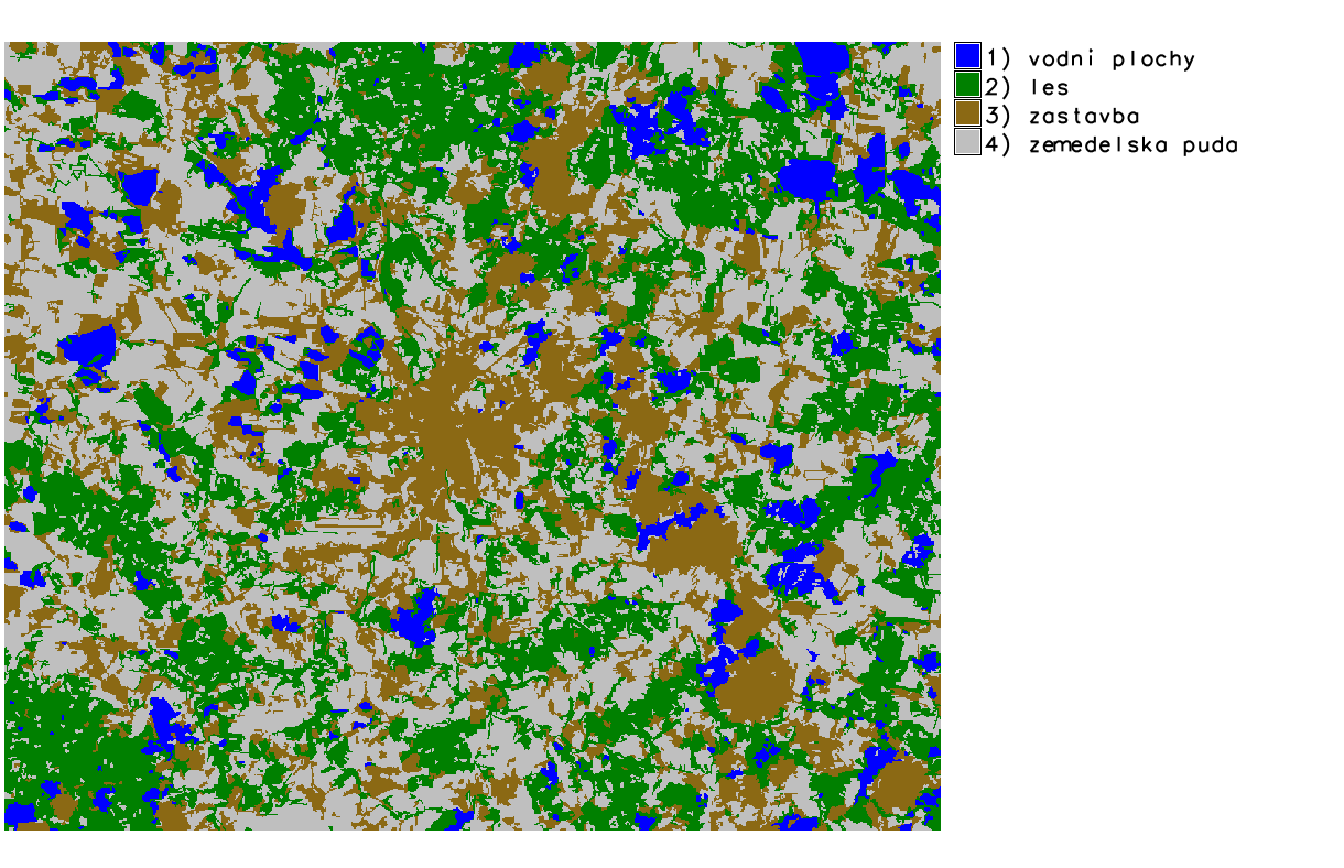
| 13. 1. 2014, 23:02 | B-obj-class.png (soubor) |  |
119 KB | Landa | Výsledek objektově orientované včetně legendy {{GRASS}} | 1 |
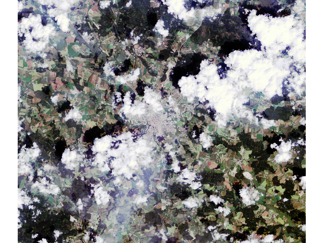
| 15. 11. 2010, 21:39 | B321.png (soubor) |  |
619 KB | Landa | Barevná syntéza 321 {{GRASS}} | 1 |
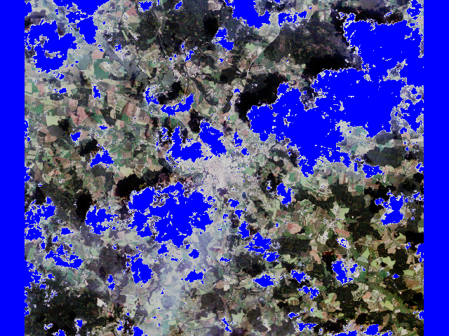
| 15. 11. 2010, 21:41 | B321 cloud.png (soubor) |  |
547 KB | Landa | Barevná syntéza 321 s maskou oblačnosti {{GRASS}} | 1 |
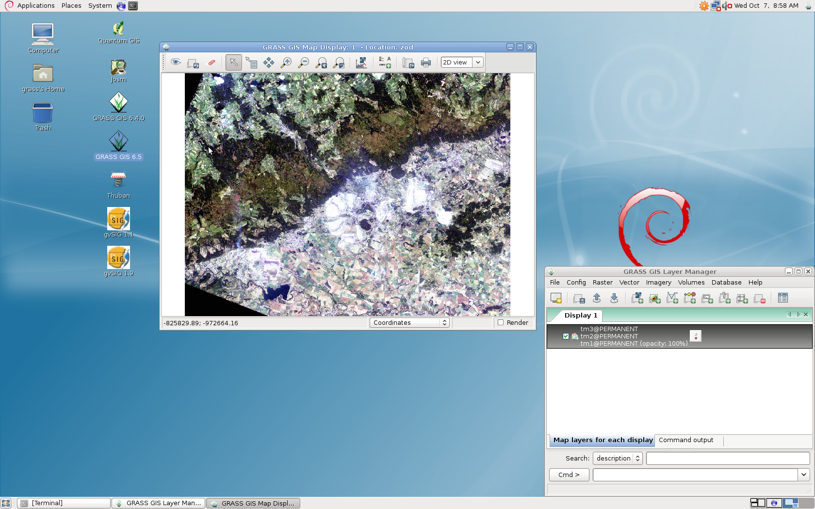
| 7. 10. 2009, 06:59 | B870-grass.png (soubor) |  |
1,15 MB | Landa | Screenshot obrazovky B870 | 1 |
| 7. 9. 2017, 13:42 | B870-ubuntu.png (soubor) |  |
2,02 MB | Landa | 2 | |
| 17. 12. 2009, 10:22 | B870a.png (soubor) |  |
294 KB | Cepek | 1 | |
| 17. 12. 2009, 10:23 | B870b.png (soubor) |  |
285 KB | Cepek | 1 | |
| 17. 12. 2009, 10:23 | B870c.png (soubor) |  |
280 KB | Cepek | 1 | |
| 15. 11. 2010, 21:41 | B acca.png (soubor) |  |
24 KB | Landa | Výsledek detekce oblačnosti {{GRASS}} | 1 |
| 27. 10. 2020, 08:03 | Bakalar.jpg (soubor) |  |
250 KB | Cajthaml | 1 | |
| 3. 12. 2007, 09:15 | Bakalari2007.jpg (soubor) | 151 KB | Cepek | Oslava promoce prvnich bakalářů studijního programu Geodézie a kartografie v listopadu 2007 | 1 | |
| 11. 12. 2017, 10:45 | Bayesova-veta.pdf (soubor) | 133 KB | Soukupl | navod k pouziti Bayesovy vety | 1 | |
| 28. 11. 2017, 20:37 | Bayesuv-vzorec.pdf (soubor) | 126 KB | Soukupl | Použití Bayesova vzorce pro odhad parametru polohy diskrétní náhodné veličiny | 1 | |
| 6. 12. 2007, 15:39 | Bc2007-490.jpg (soubor) |  |
143 KB | Cepek | 1 | |
| 6. 12. 2007, 15:39 | Bc2007-499.jpg (soubor) |  |
117 KB | Cepek | 1 | |
| 6. 12. 2007, 15:40 | Bc2007-528.jpg (soubor) |  |
91 KB | Cepek | 1 |