Seznam souborů
Tato speciální stránka zobrazuje všechny načtené soubory.
| Datum | Název | Náhled | Velikost (bajtů) | Uživatel | Popis | Verze |
|---|---|---|---|---|---|---|
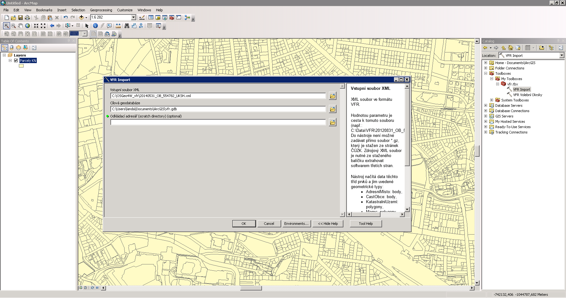
| 2. 12. 2014, 21:44 | Arcgis-vfr.png (soubor) |  |
146 KB | Landa | Import dat VFR do prostředí Esri ArcGIS {{ArcGIS}} | 1 |
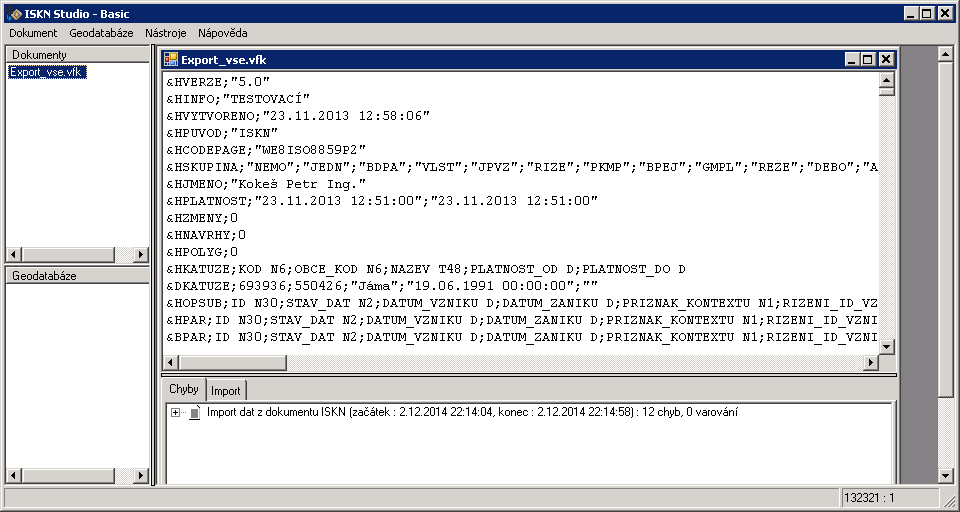
| 2. 12. 2014, 21:18 | Iskn-studio.png (soubor) |  |
18 KB | Landa | ISKN Studio pro práci s daty ve formátu VFK {{ArcGIS}} | 1 |
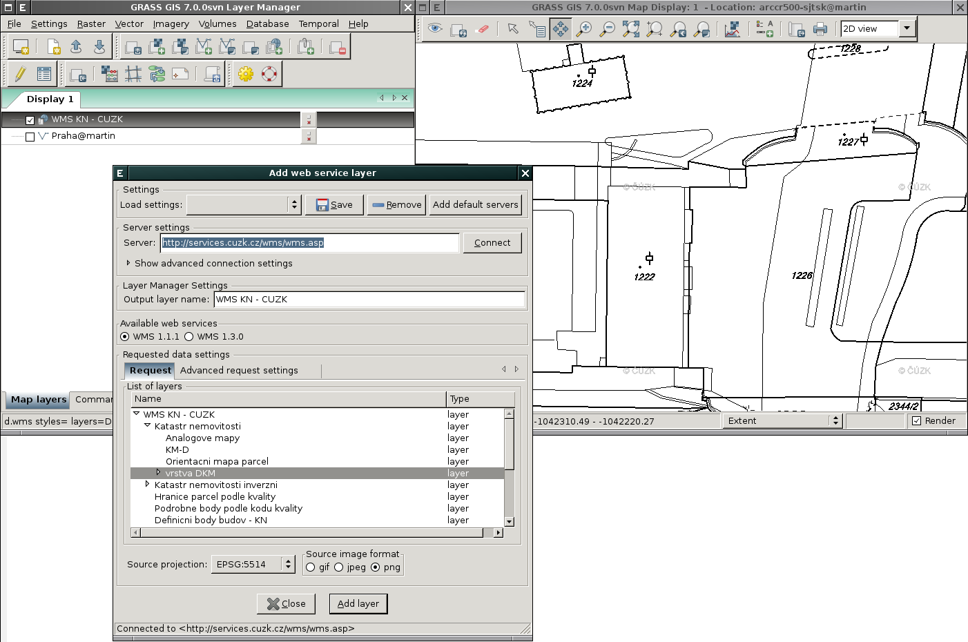
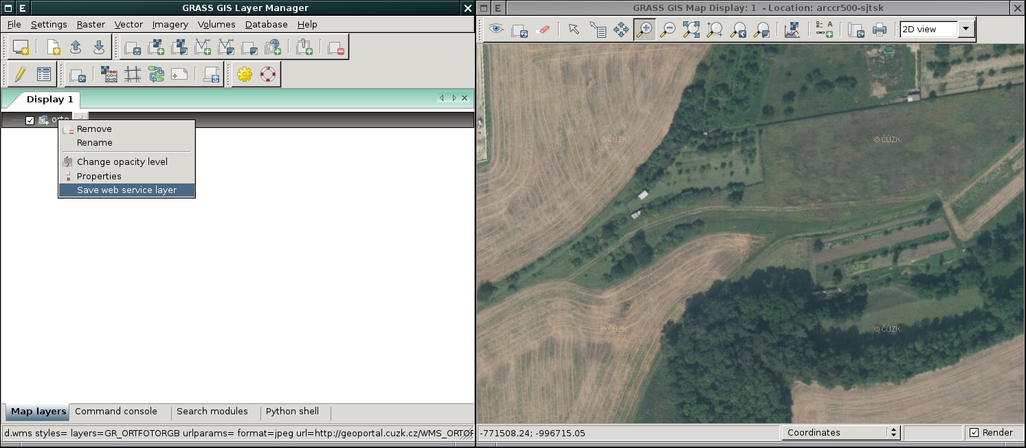
| 11. 11. 2014, 18:51 | Grass-wms.png (soubor) |  |
112 KB | Landa | WMS služba ĆÚZK v systému GRASS {{GRASS}} | 1 |
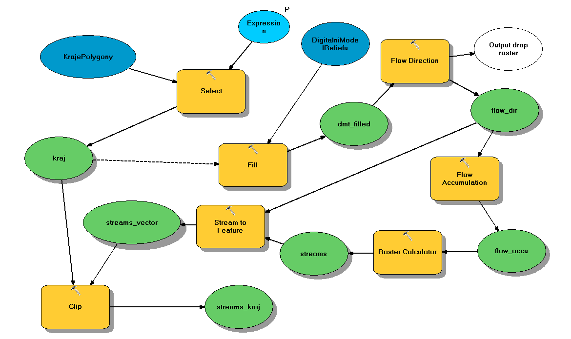
| 4. 11. 2014, 21:16 | Gis-1-2014-u01.gif (soubor) |  |
682 KB | Landa | 1 | |
| 3. 11. 2014, 22:55 | Wxgui-dbmgr-stats-1.png (soubor) |  |
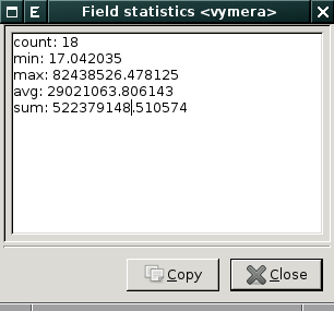
11 KB | Landa | Příklad statistiky {{GRASS}} | 1 |
| 3. 11. 2014, 22:55 | Wxgui-dbmgr-stats-0.png (soubor) |  |
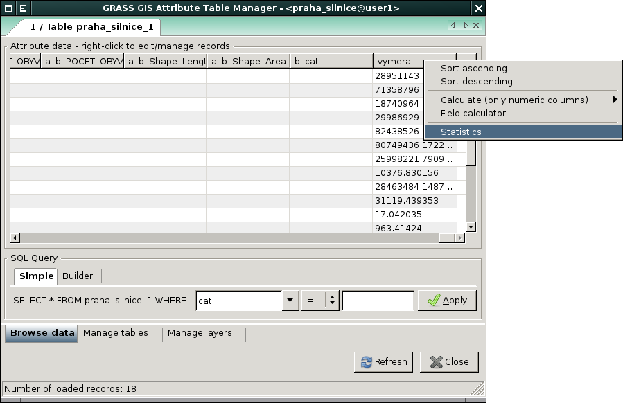
48 KB | Landa | GRASS od verze 7.1 disponuje možnosti zobrazit statistiku vybraného atributu přímo ze Správce atributových dat {{GRASS}} | 1 |
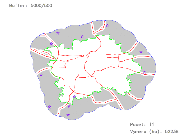
| 23. 10. 2014, 16:02 | Gis-1-2014-u01-5000-50.png (soubor) |  |
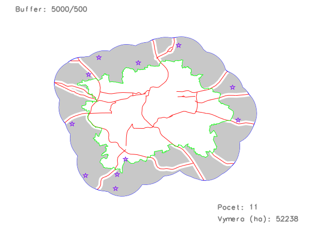
58 KB | Landa | Přiklad vizualizace výsledku (pouze pro ilustraci) | 1 |
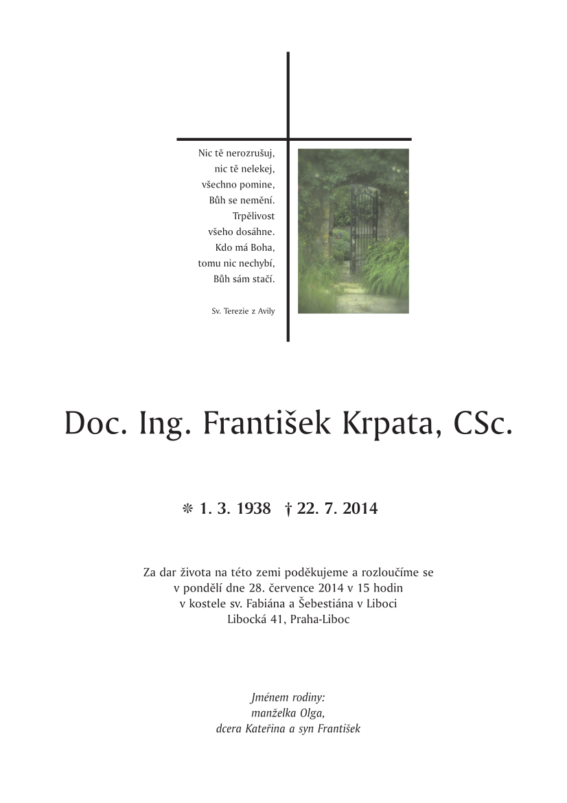
| 23. 7. 2014, 08:53 | Parte František Krpata-cropped.png (soubor) |  |
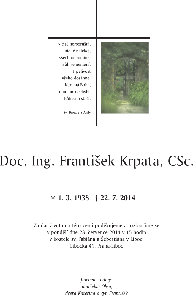
157 KB | Cepek | Doc. Ing. František Krpata, CSc. * 1.3.1938 +22.7.2014 | 1 |
| 23. 7. 2014, 08:48 | Parte František Krpata.png (soubor) |  |
161 KB | Cepek | Doc. Ing. František Krpata, CSc. * 1.3.1938 + 22.7.2014 | 1 |
| 20. 5. 2014, 14:49 | Grass-gis2-cv9-1.png (soubor) |  |
149 KB | Landa | Spuštění úlohy modeleru v systému GRASS {{GRASS}} | 1 |
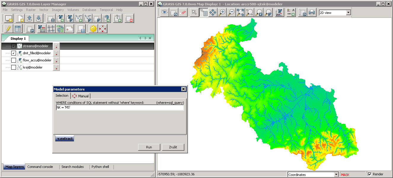
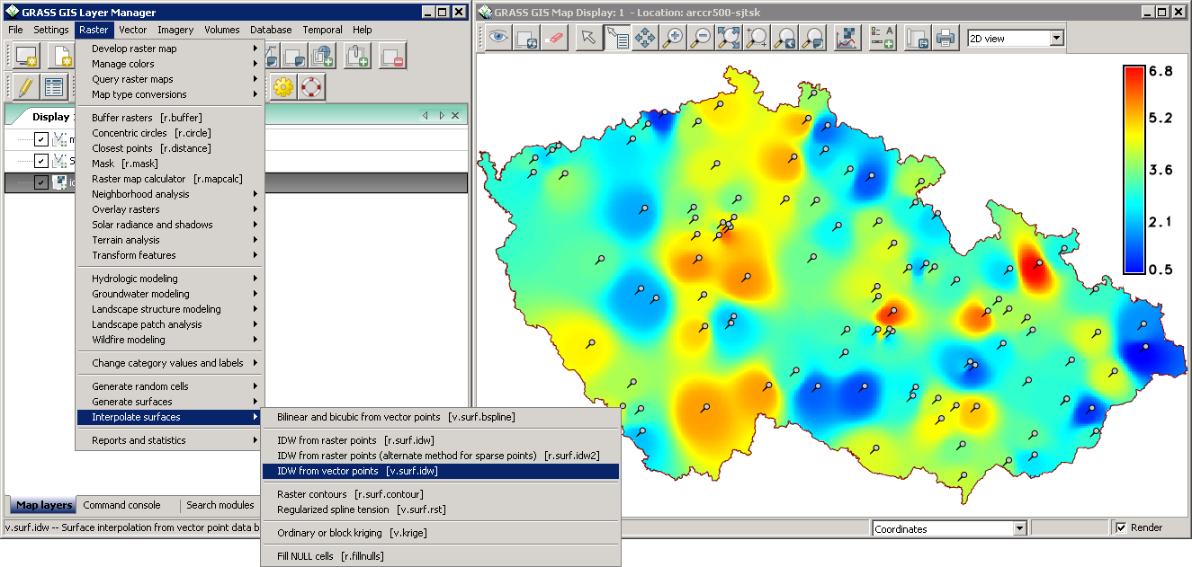
| 20. 5. 2014, 14:41 | Grass-gis2-cv9.png (soubor) |  |
12 KB | Landa | Řešení úlohy devátého cvičení GIS 2 v systému GRASS {{GRASS}} | 1 |
| 20. 5. 2014, 14:11 | Arcgis-gis2-cv9-1.png (soubor) |  |
331 KB | Landa | Spuštění úlohy modeleru v ArcGIS {{ArcGIS}} | 1 |
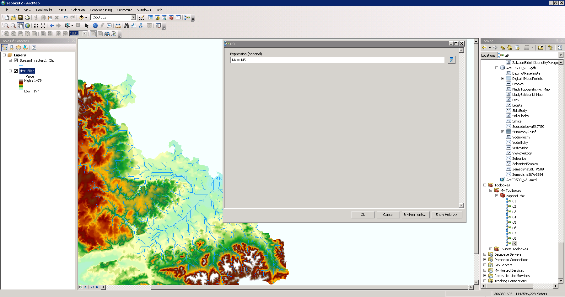
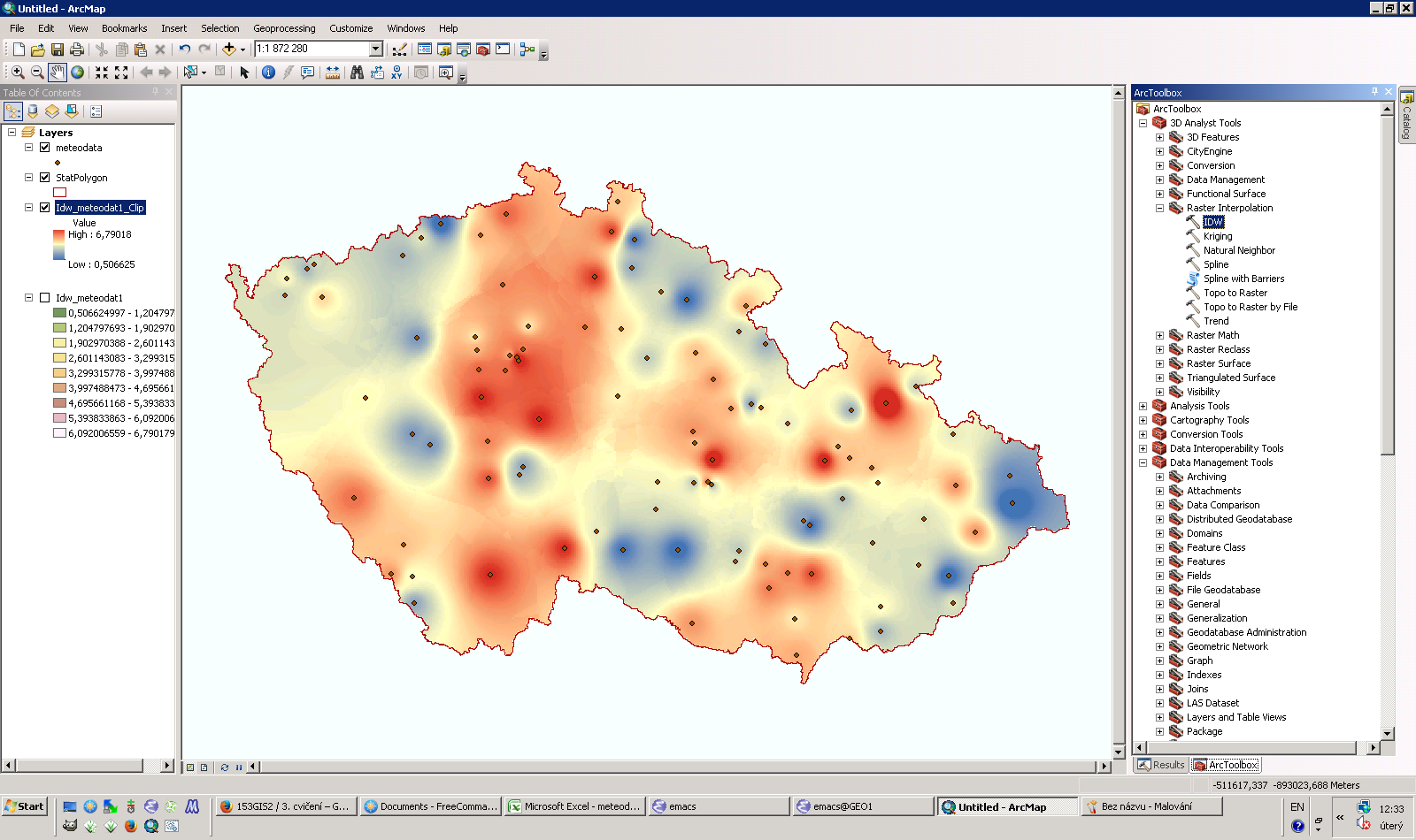
| 20. 5. 2014, 14:00 | Arcgis-gis2-cv9.png (soubor) |  |
24 KB | Landa | Řešení úlohy devátého cvičení GIS 2 v ArcGIS {{ArcGIS}} | 1 |
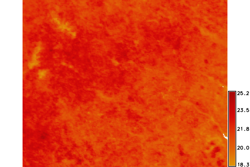
| 29. 4. 2014, 20:23 | Modis-spring-avg.png (soubor) |  |
200 KB | Landa | Průměrné teploty pro roční období 'jaro' (tabulka barev 'celsius') {{GRASS}} | 1 |
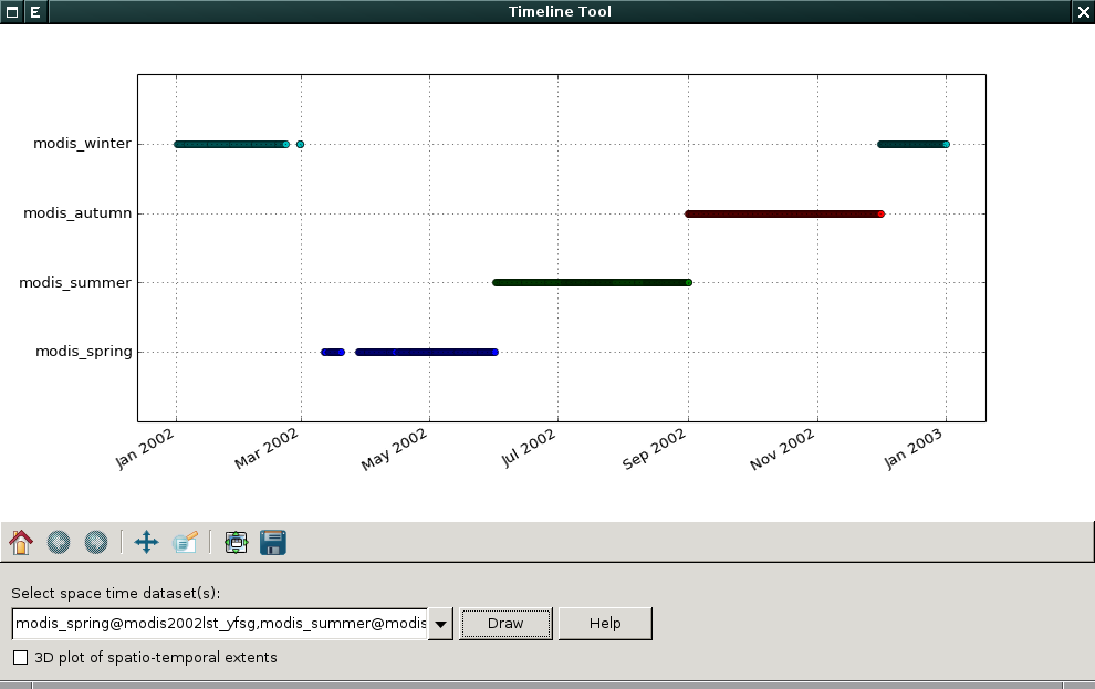
| 29. 4. 2014, 19:17 | G-gui-timeline-modis-4.png (soubor) |  |
40 KB | Landa | Vizualizace čtyř časoprostorových datasetů na základě ročního období {{GRASS}} | 1 |
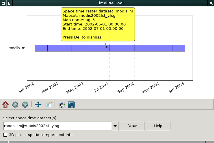
| 29. 4. 2014, 17:44 | G-gui-timeline-modis.png (soubor) |  |
45 KB | Landa | Vizualizace časové osy agregovaných LTS dat {{GRASS}} | 1 |
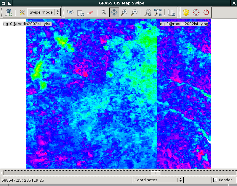
| 29. 4. 2014, 17:37 | G-gui-mapswipe-modis.png (soubor) |  |
213 KB | Landa | Vizualizace agregovaných LTS dat pro první dva měsíce roku 2002 {{GRASS}} | 1 |
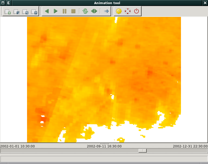
| 23. 4. 2014, 12:32 | G-gui-animation.png (soubor) |  |
107 KB | Landa | wxGUI Animation Tool {{wxGUI}} | 1 |
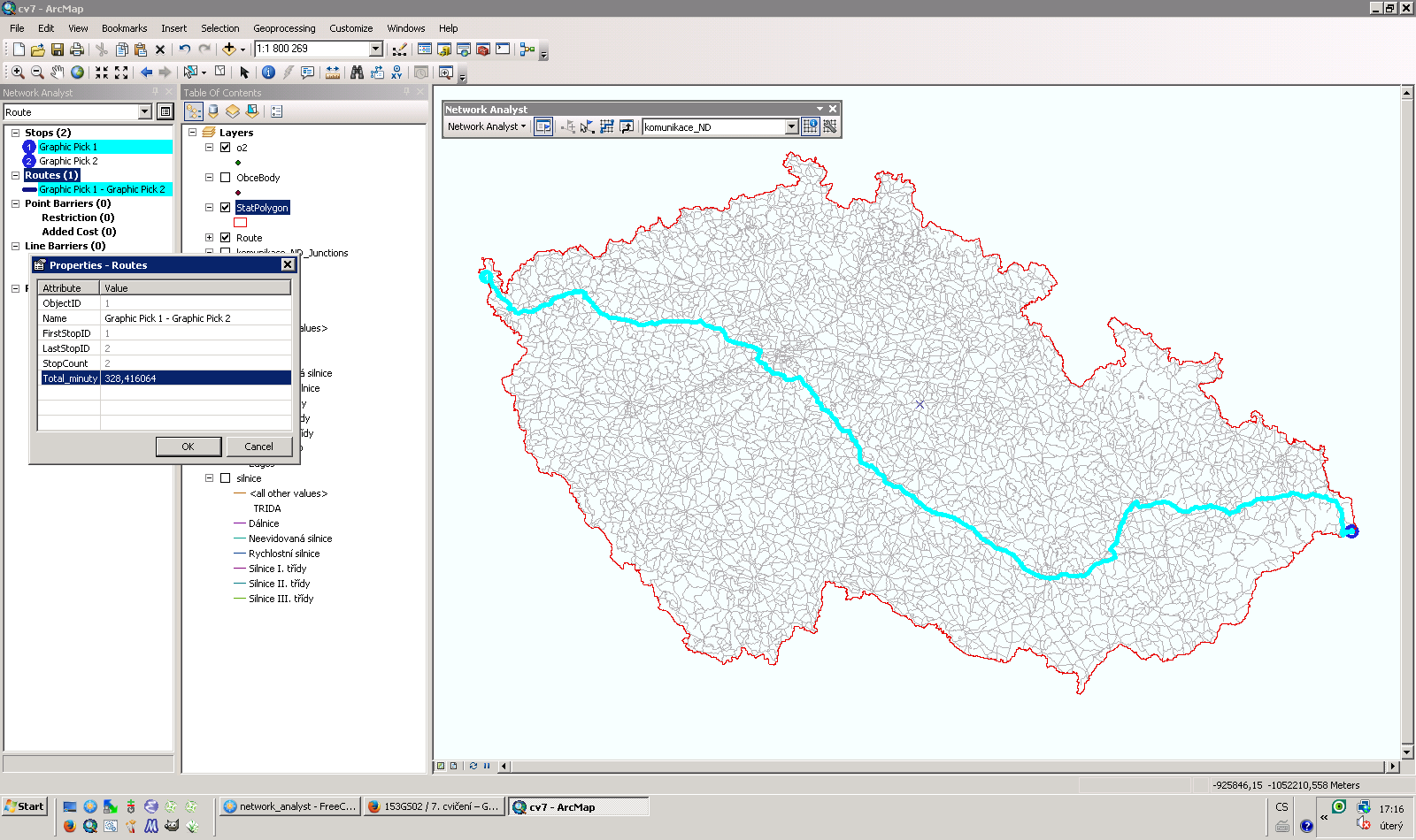
| 8. 4. 2014, 15:19 | Grass-gis2-cv7.png (soubor) |  |
183 KB | Landa | Řešení první úlohy sedmého cvičení GIS 2 v ArcGIS {{ArcGIS}} | 1 |
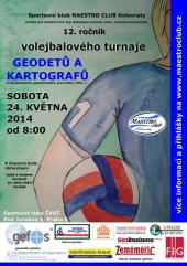
| 2. 4. 2014, 22:16 | Volejbal-gk2014-plakat-170px.jpg (soubor) |  |
12 KB | Soucek | Plakát pro turnaj GK 2014 | 1 |
| 31. 3. 2014, 14:44 | Arcgis-gis2-cv6.png (soubor) |  |
196 KB | Landa | Řešení první a druhé úlohy pátého cvičení GIS 2 v ArcGIS {{ArcGIS}} | 1 |
| 22. 3. 2014, 13:09 | Arcgis-gis2-cv5.png (soubor) |  |
179 KB | Landa | Řešení první úlohy čtvrtého cvičení GIS 2 v ArcGIS {{ArcGIS}} | 1 |
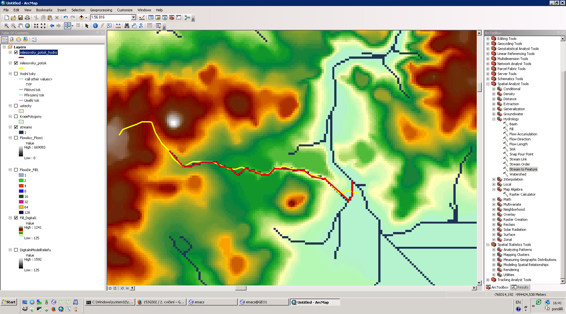
| 11. 3. 2014, 11:49 | Grass-gis2-cv4.png (soubor) |  |
48 KB | Landa | Řešení první úlohy čtvrtého cvičení GIS 2 v systému GRASS {{GRASS}} | 1 |
| 11. 3. 2014, 11:23 | Arcgis-gis2-cv4.png (soubor) |  |
100 KB | Landa | Řešení první úlohy čtvrtého cvičení GIS 2 v ArcGIS {{ArcGIS}} | 1 |
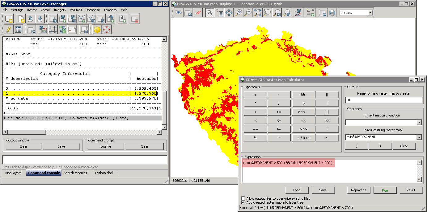
| 4. 3. 2014, 14:06 | Grass-gis2-cv3.png (soubor) |  |
125 KB | Landa | Řešení první úlohy třetího cvičení GIS 2 v systému GRASS {{GRASS}} | 1 |
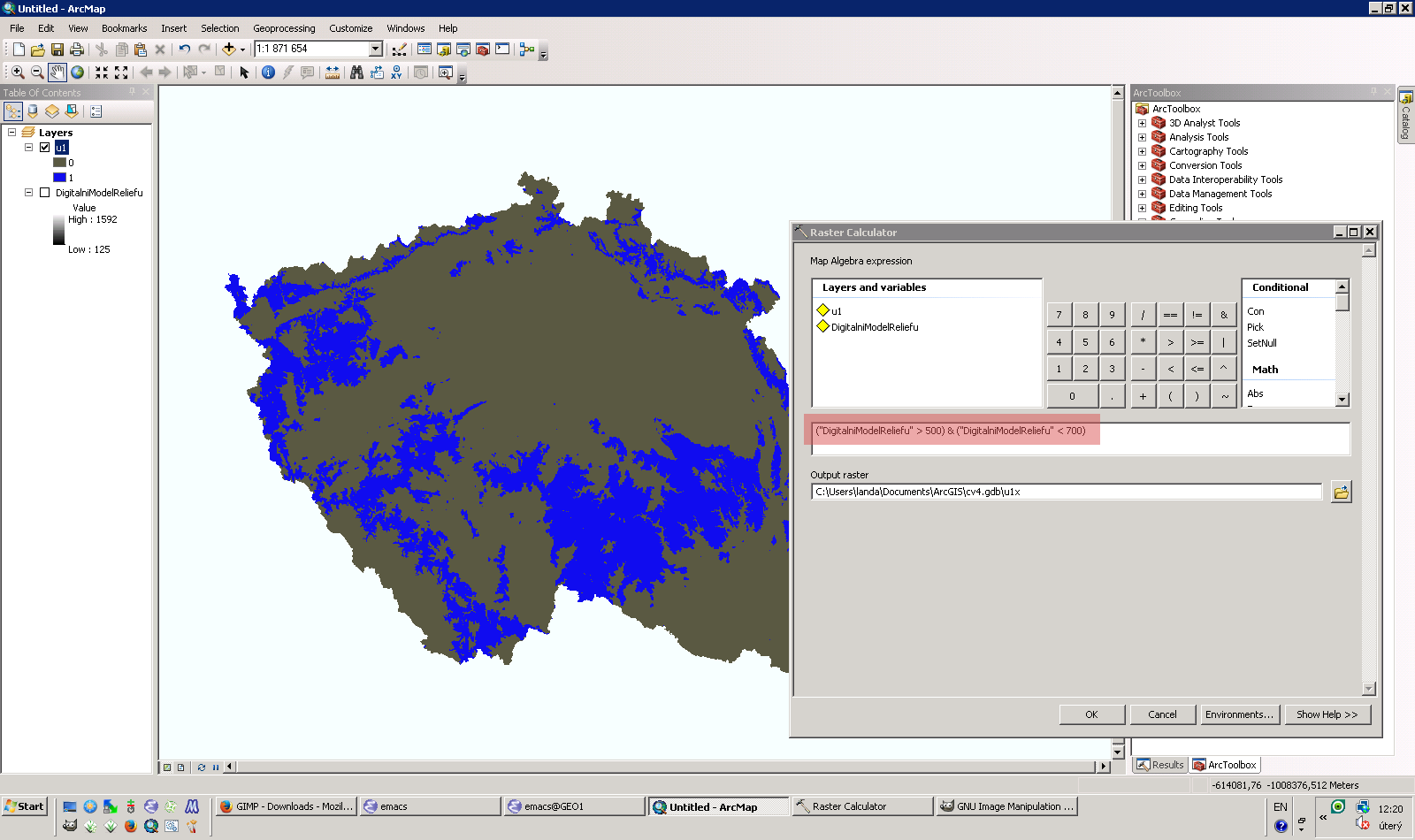
| 4. 3. 2014, 11:37 | Arcgis-gis2-cv3.png (soubor) |  |
221 KB | Landa | Řešení první úlohy třetího cvičení GIS 2 v ArcGIS {{ArcGIS}} | 1 |
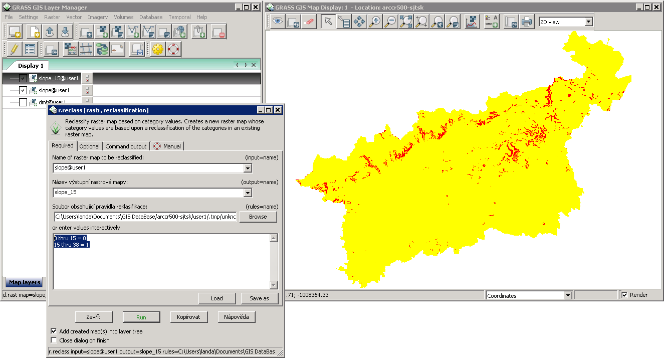
| 26. 2. 2014, 08:47 | Grass-gis2-cv2.png (soubor) |  |
46 KB | Landa | Reklasifikace rastrové mapy sklonu svahu v systému GRASS {{GRASS}} | 1 |
| 21. 2. 2014, 14:25 | LH.png (soubor) |  |
72 KB | Holubec | 1 | |
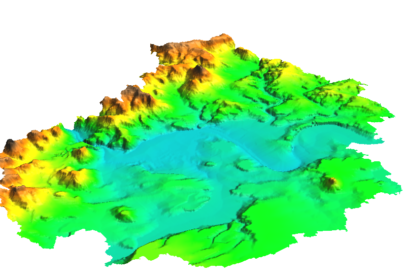
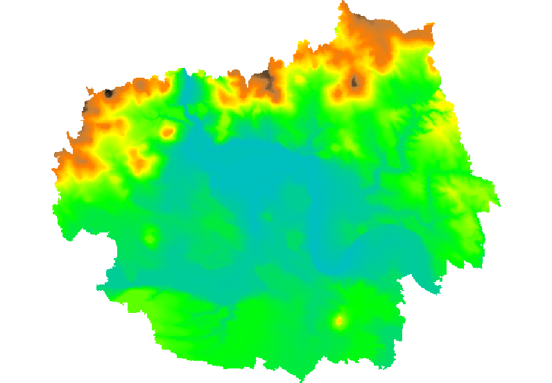
| 19. 2. 2014, 08:42 | Grass-dmt-ltm-3d.png (soubor) |  |
306 KB | Landa | Vygenerovaný DMT z vektorových vrstevnic (3D pohled) {{GRASS}} | 1 |
| 19. 2. 2014, 08:42 | Grass-dmt-ltm-2d.png (soubor) |  |
119 KB | Landa | Vygenerovaný DMT z vektorových vrstevnic (2D pohled) {{GRASS}} | 1 |
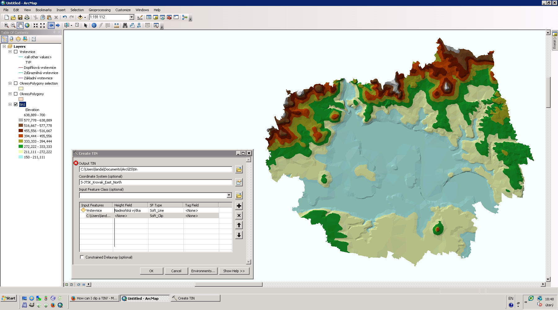
| 18. 2. 2014, 17:50 | Arcgis-tin-ltm.png (soubor) |  |
257 KB | Landa | TIN pro okres Litoměřice {{ArcGIS}} | 1 |
| 4. 2. 2014, 08:10 | GIS-pro-srazkova-data-z-MV-spoju.pdf (soubor) | 353 KB | Landa | 1 | ||
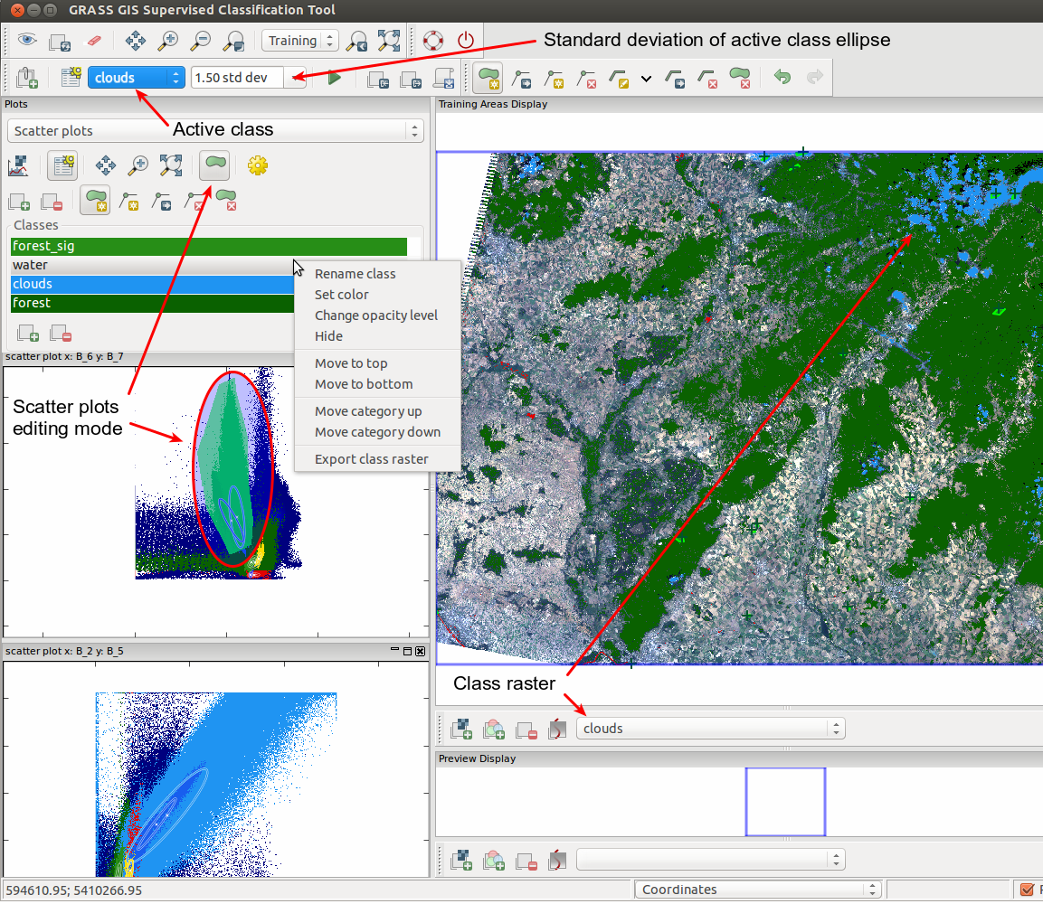
| 1. 2. 2014, 19:37 | Iclass scatter plot.png (soubor) |  |
967 KB | Landa | wxGUI Interactive Scatter Plot Tool {{GRASS}} | 1 |
| 31. 1. 2014, 13:38 | Osgeo-logo.png (soubor) | 11 KB | Landa | 1 | ||
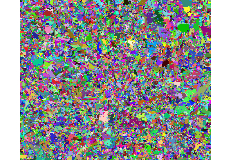
| 13. 1. 2014, 23:02 | B-obj-class.png (soubor) |  |
119 KB | Landa | Výsledek objektově orientované včetně legendy {{GRASS}} | 1 |
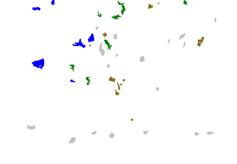
| 13. 1. 2014, 20:44 | Tr-areas-obj-class.png (soubor) |  |
24 KB | Landa | Vektorová mapa trénovacích ploch s nastavenou tabulkou barev {{GRASS}} | 1 |
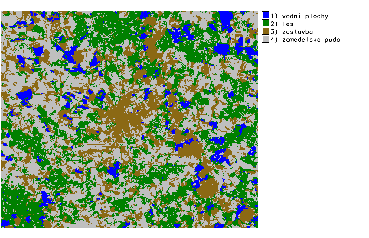
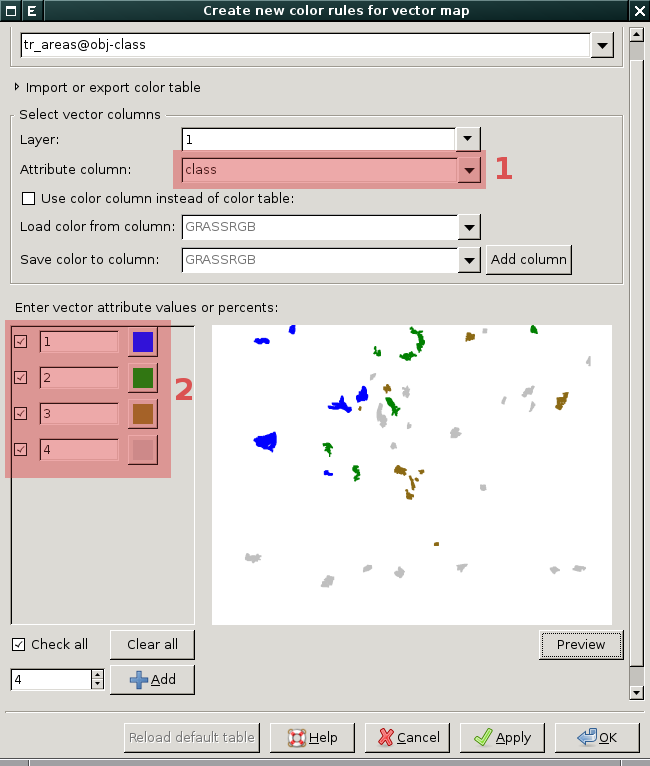
| 13. 1. 2014, 20:41 | Tr-areas-color-obj-class.png (soubor) |  |
49 KB | Landa | Nastavení tabulky barev pro vektorovou mapu trénovacích ploch: (1) vodní plochy (2) les (3) zástavba (4) zemědělská půda {{GRASS}} | 1 |
| 13. 1. 2014, 20:12 | Training-areas-obj-class.png (soubor) |  |
198 KB | Landa | Příklad volby trénovacích ploch na základě barevné syntézy 453 {{GRASS}} | 1 |
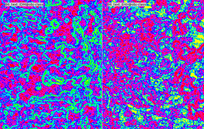
| 13. 1. 2014, 19:00 | R-texture-obj-class.png (soubor) |  |
348 KB | Landa | 1 | |
| 13. 1. 2014, 18:00 | I-segment-obj-class.png (soubor) |  |
363 KB | Landa | 1 | |
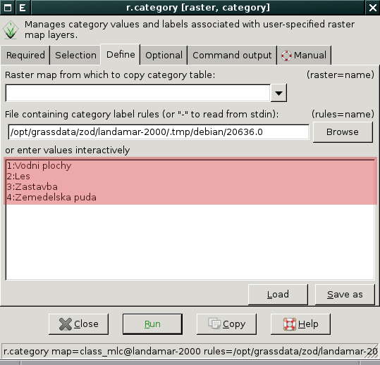
| 12. 1. 2014, 20:22 | ZOD-cv11-r-category.png (soubor) |  |
34 KB | Landa | Nastavení popisků tříd pomocí modulu r.category {{GRASS}} | 1 |
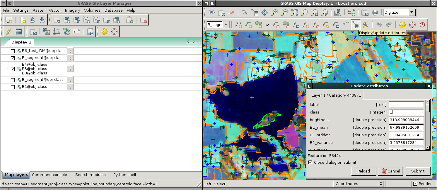
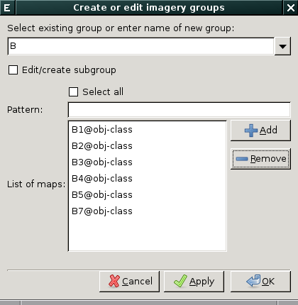
| 11. 1. 2014, 16:43 | Grass-group-dialog-B.png (soubor) |  |
20 KB | Landa | Založení obrazové skupiny ve wxGUI {{GRASS}} | 1 |
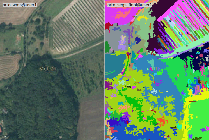
| 18. 12. 2013, 13:32 | Orto segs final porovnani.png (soubor) |  |
128 KB | Landa | Porovnání ortofota a výsledku segmentace obrazu {{GRASS}} | 1 |
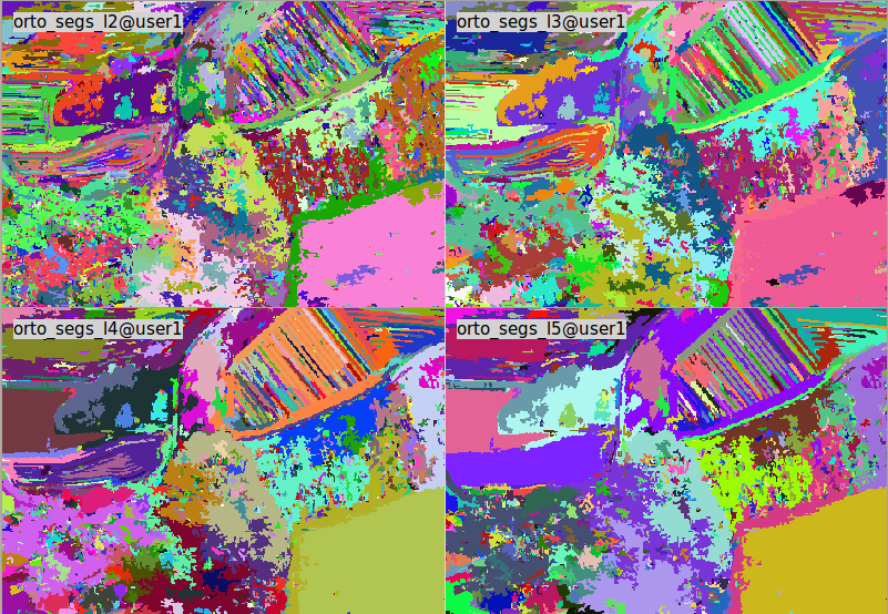
| 18. 12. 2013, 13:21 | Orto segs l2 l5.png (soubor) |  |
243 KB | Landa | Další pokusy o segmentaci obrazu {{GRASS}} | 1 |
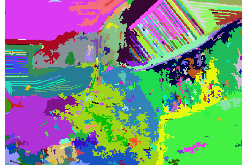
| 18. 12. 2013, 13:13 | Orto segs final.png (soubor) |  |
42 KB | Landa | První pokus o segmentaci obrazu {{GRASS}} | 1 |
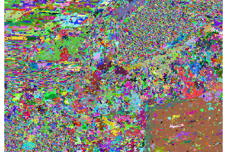
| 18. 12. 2013, 13:10 | Orto segs l1.png (soubor) |  |
272 KB | Landa | První pokus o segmentaci obrazu {{GRASS}} | 1 |
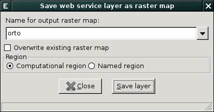
| 18. 12. 2013, 08:38 | Grass-wms-save-dialog.png (soubor) |  |
13 KB | Landa | Dialog pro uložení WMS vrstvy jako rastrové mapy {{GRASS}} | 1 |
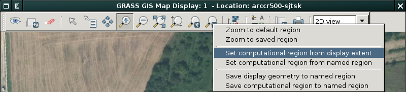
| 18. 12. 2013, 08:33 | Grass-set-region-from-extent.png (soubor) | 87 KB | Landa | Nastavení rozsahu výpočetního regionu z mapového displaje {{GRASS}} | 1 | |
| 18. 12. 2013, 08:28 | Grass-wms-save.png (soubor) |  |
565 KB | Landa | Uložení WMS vrstvy do rastrové mapy {{GRASS}} | 1 |
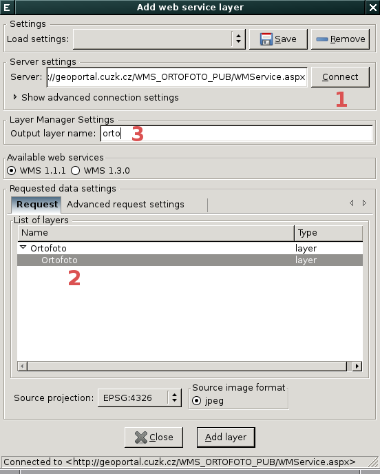
| 18. 12. 2013, 08:25 | Grass-add-wms-dialog.png (soubor) |  |
46 KB | Landa | Dialog pro přidání nové WMS vrstvy {{GRASS}} | 1 |