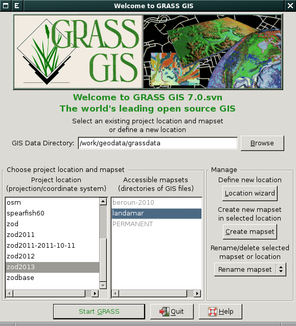
Seznam souborů
Tato speciální stránka zobrazuje všechny načtené soubory.
| Datum | Název | Náhled | Velikost (bajtů) | Uživatel | Popis | Verze |
|---|---|---|---|---|---|---|
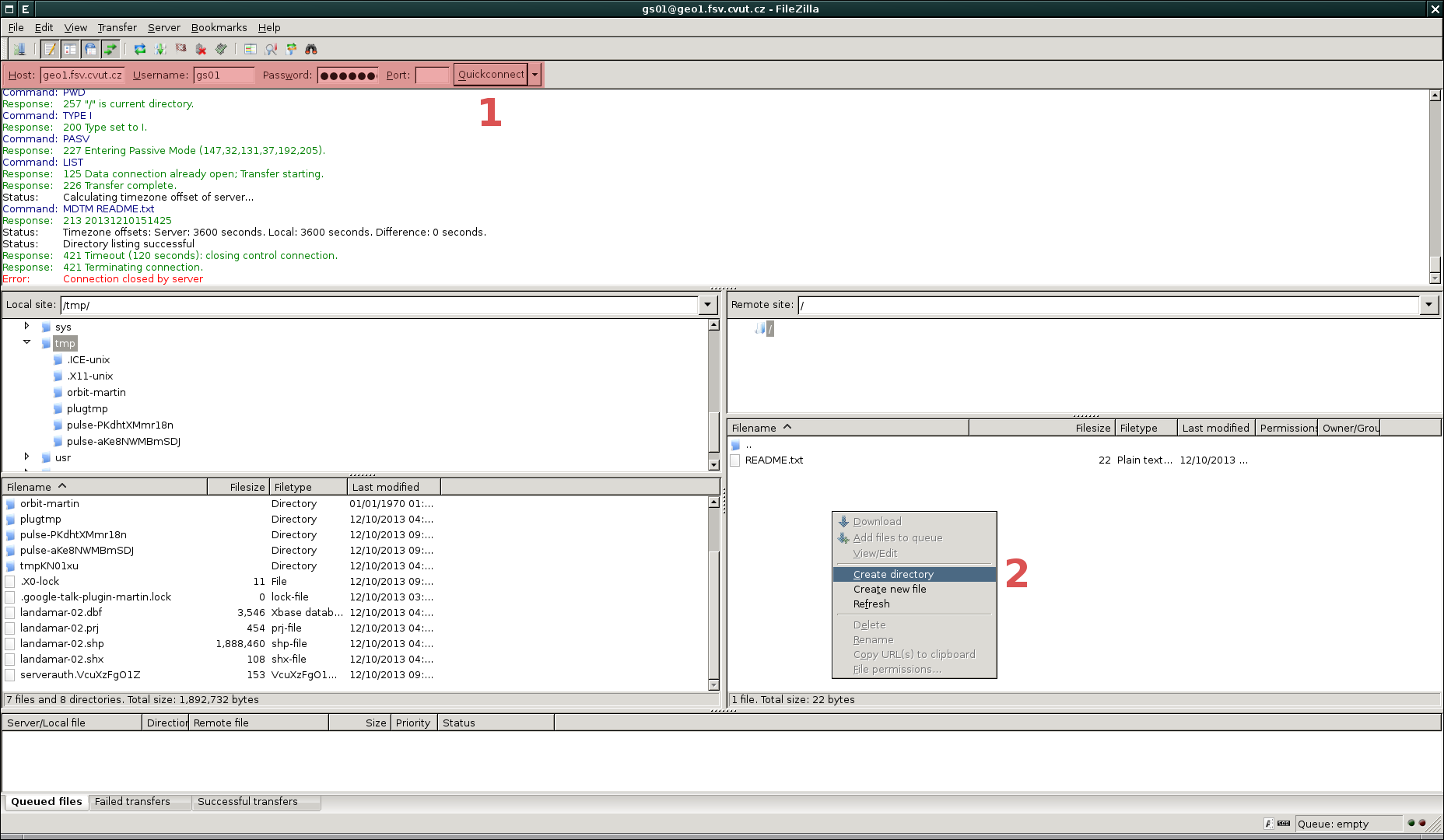
| 10. 12. 2013, 15:44 | Filezilla-gs-01-0.png (soubor) |  |
157 KB | Landa | 2 | |
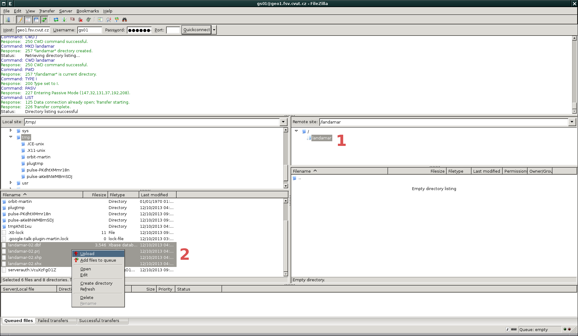
| 10. 12. 2013, 15:43 | Filezilla-gs-01-3.png (soubor) |  |
165 KB | Landa | 1 | |
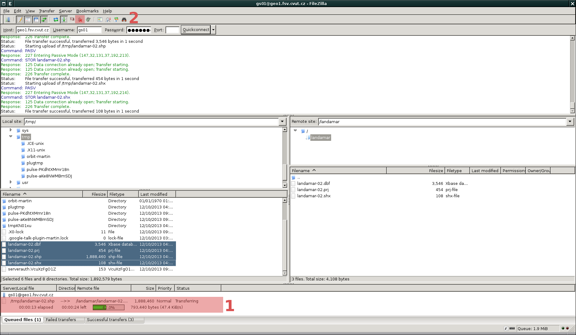
| 10. 12. 2013, 15:41 | Filezilla-gs-01-2.png (soubor) |  |
147 KB | Landa | Vybere se cílový adresář (1) a následně na to se zvolené soubory nahrají do tohoto adresáře na FTP serveru (2) | 1 |
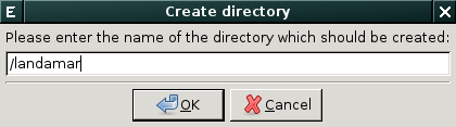
| 10. 12. 2013, 15:40 | Filezilla-gs-01-1.png (soubor) |  |
8 KB | Landa | Dialog pro vytvoření adresáře na FTP serveru | 1 |
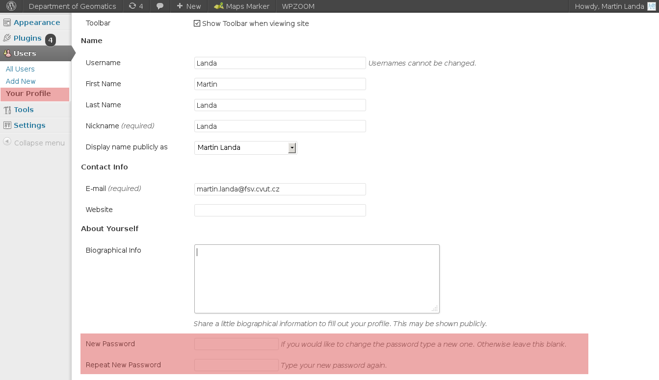
| 9. 12. 2013, 15:01 | Wordpress-change-passwd.png (soubor) |  |
63 KB | Landa | 1 | |
| 5. 12. 2013, 09:54 | HERE zmeny.pdf (soubor) | 79 KB | Holubec | Seznam studentů a jimi provedených změn na portálu HERE.com | 1 | |
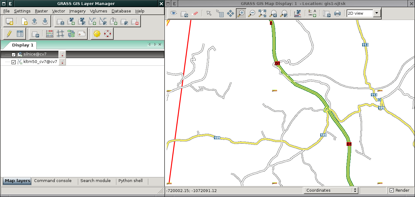
| 27. 11. 2013, 10:58 | Grass-vektorizace-gs01-07.png (soubor) |  |
106 KB | Landa | Řešení první úlohy v systému GRASS {{GRASS}} | 1 |
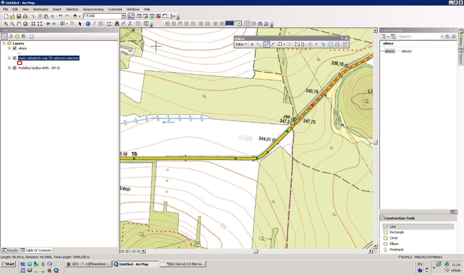
| 27. 11. 2013, 10:27 | Arcgis-vektorizace-gs01-07.png (soubor) |  |
319 KB | Landa | Řešení první úlohy v systému ArcGIS {{GIS}} | 1 |
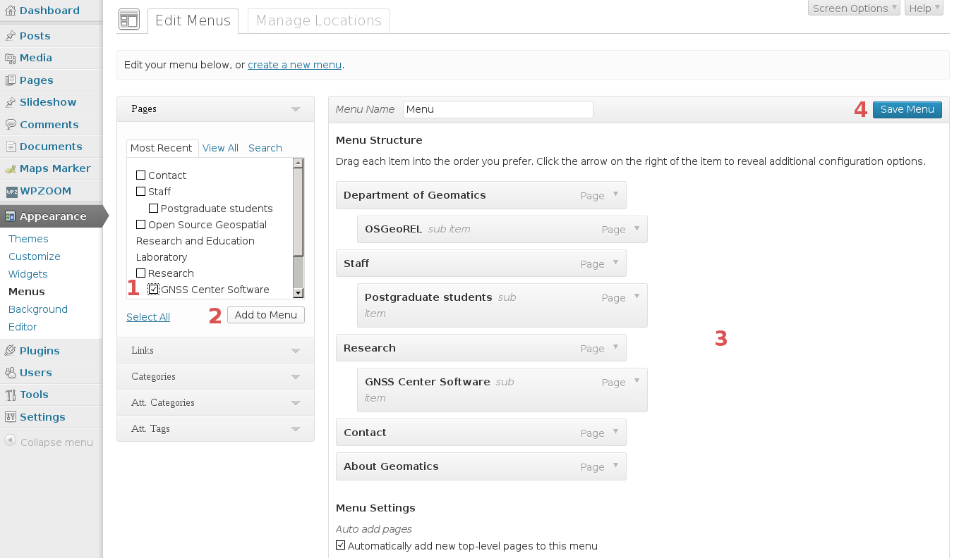
| 24. 11. 2013, 16:48 | Wordpress-menu-research.png (soubor) | 38 KB | Landa | Hlavní menu webových stránek katedry 155 {{WordPress}} | 1 | |
| 24. 11. 2013, 16:45 | Wordpress-menu.png (soubor) |  |
116 KB | Landa | 1 | |
| 21. 11. 2013, 13:05 | Wordpress-login-0.png (soubor) |  |
278 KB | Landa | 1 | |
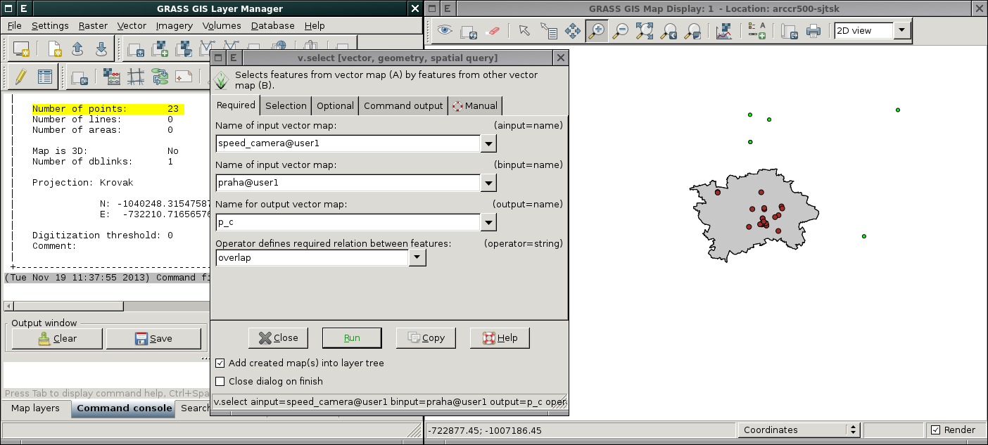
| 19. 11. 2013, 10:41 | Grass-gs01-6-1.png (soubor) |  |
108 KB | Landa | Řešení první úlohy v systému GRASS GIS {{GRASS}} | 1 |
| 19. 11. 2013, 10:33 | Arcgis-gs01-6-1.png (soubor) |  |
75 KB | Landa | Řešení první úlohy v systému ArcGIS {{GIS}} | 1 |
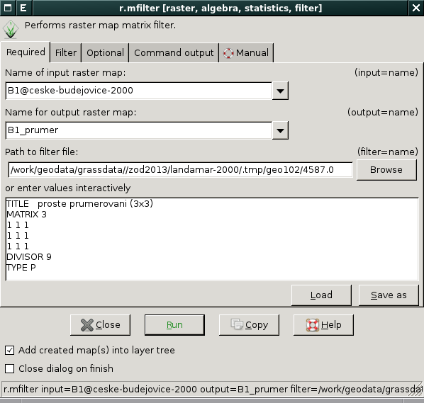
| 19. 11. 2013, 09:46 | Grass-r-mfilter.png (soubor) |  |
41 KB | Landa | GUI dialog modulu r.mfilter {{GRASS}} | 1 |
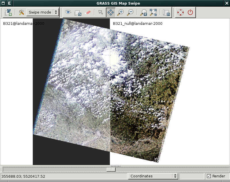
| 6. 11. 2013, 15:56 | Grass-rgb-null.png (soubor) |  |
444 KB | Landa | Porovnání barevné syntézy s hodnotami 0 a NULL {{GRASS}} | 1 |
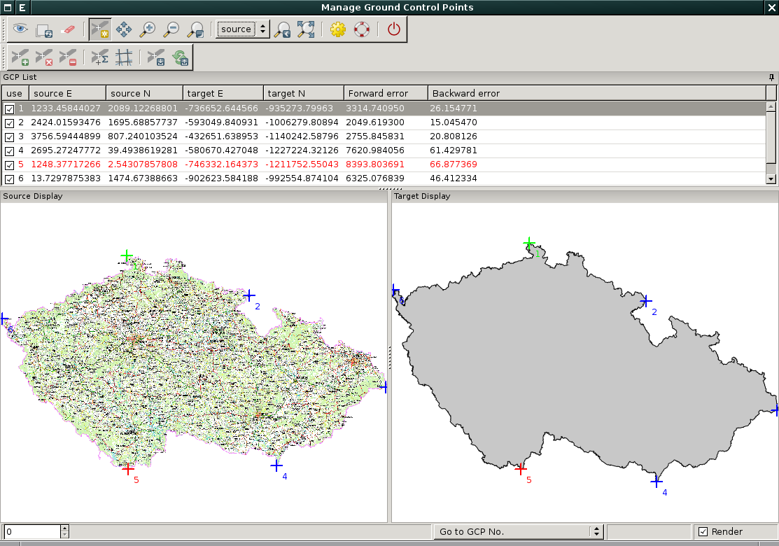
| 5. 11. 2013, 18:23 | Grass-georect.png (soubor) |  |
231 KB | Landa | Souřadnicové připojení rastru cesko800.gif v systému ArcGIS {{GRASS}} | 1 |
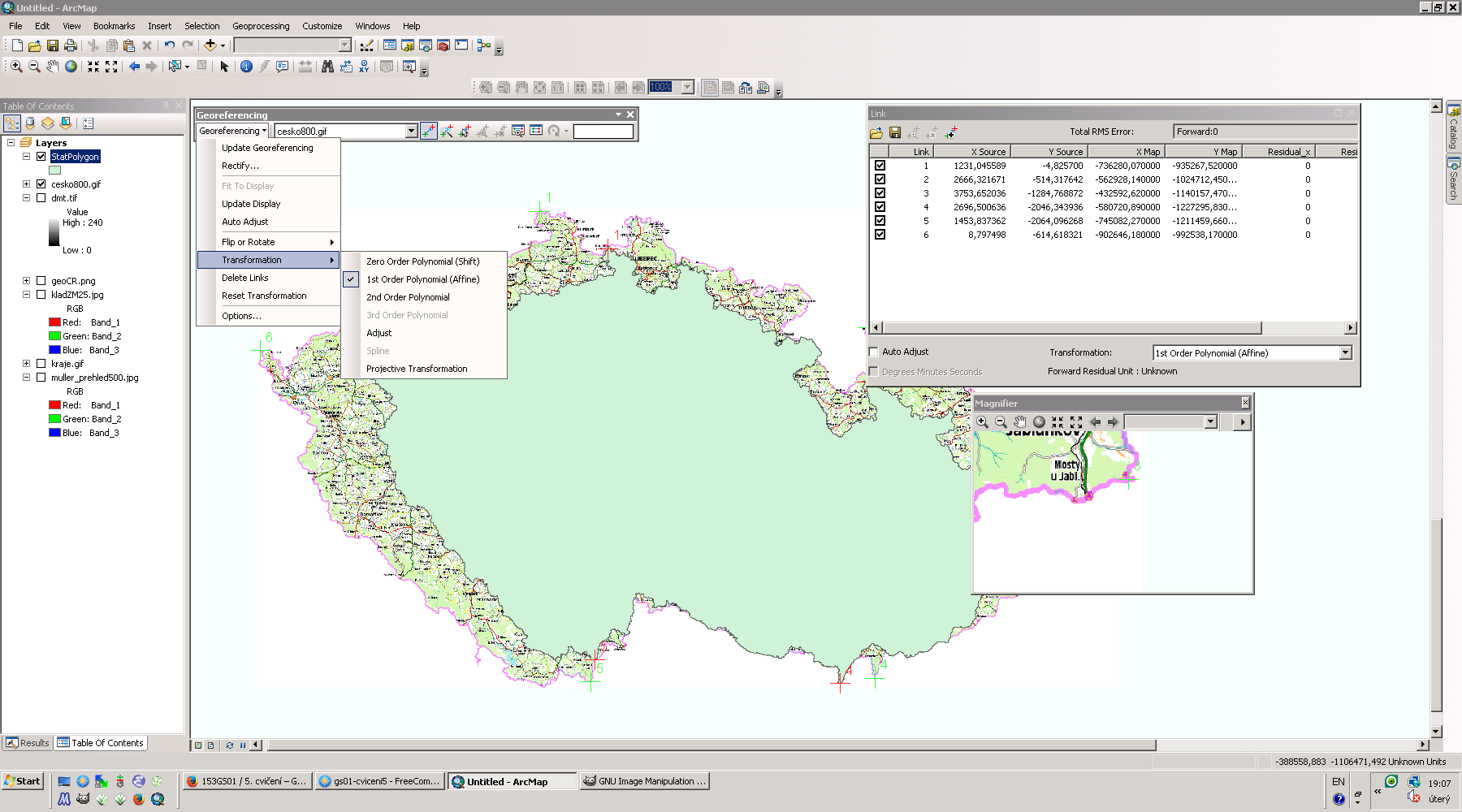
| 5. 11. 2013, 18:09 | Arcgis-georef.png (soubor) |  |
230 KB | Landa | Souřadnicové připojení rastru cesko800.gif v systému ArcGIS {{GIS}} | 1 |
| 5. 11. 2013, 14:25 | Grass-clip.png (soubor) |  |
190 KB | Landa | Řešení první úlohy v systému GRASS | 1 |
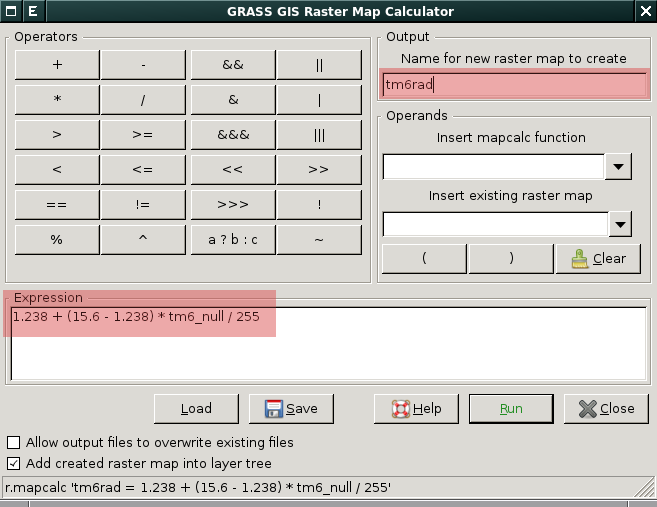
| 30. 10. 2013, 16:37 | Wxgui-r-mapcalc-temp.png (soubor) |  |
33 KB | Landa | Výpočet mapy teploty povrchu v rastrovém kalkulátoru wxGUI {{GRASS}} | 1 |
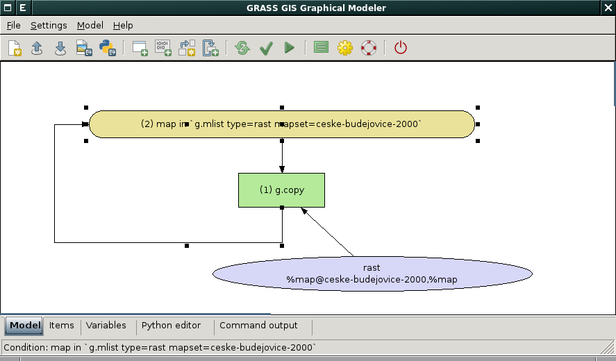
| 30. 10. 2013, 15:45 | Wxgui-gmodeler-copy-map.png (soubor) |  |
31 KB | Landa | Hromadné kopírování rastrových map v grafickém modeleru {{grass}} | 1 |
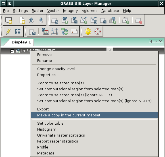
| 30. 10. 2013, 15:31 | Wxgui-copy-map.png (soubor) |  |
42 KB | Landa | Vytvoření kopie rastrové či vektorové mapy z kontextového menu Layer Manageru {{GRASS}} | 1 |
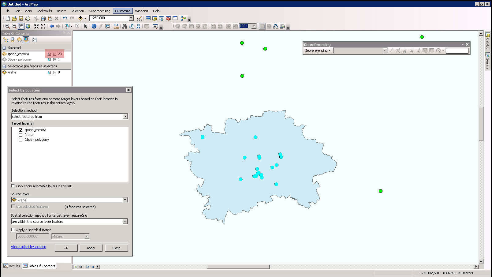
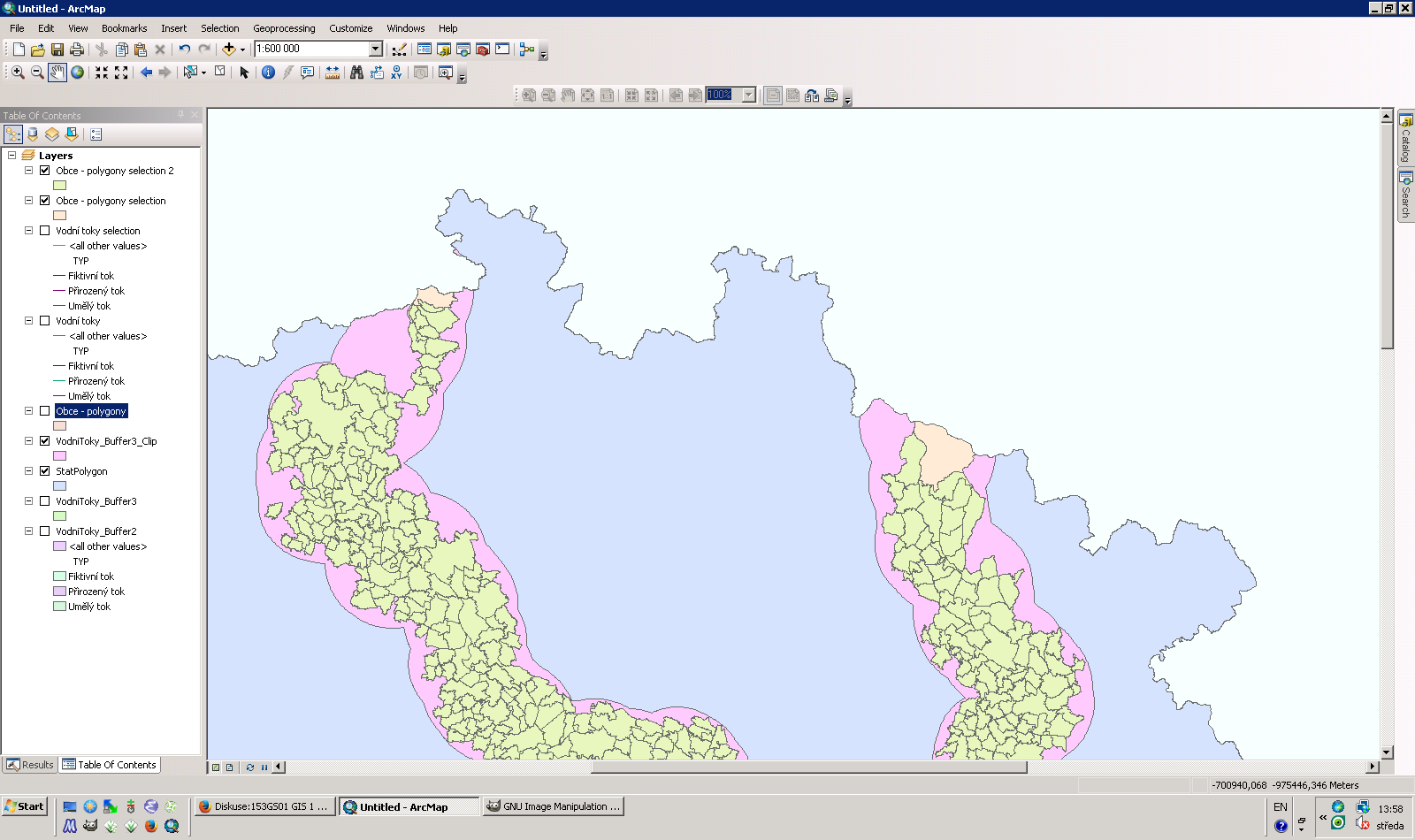
| 30. 10. 2013, 13:01 | Arcgis-gis1-4-uloha-3.png (soubor) |  |
111 KB | Landa | Porovnání prostorového vztahu "within" a "completely within" {{GIS}} | 1 |
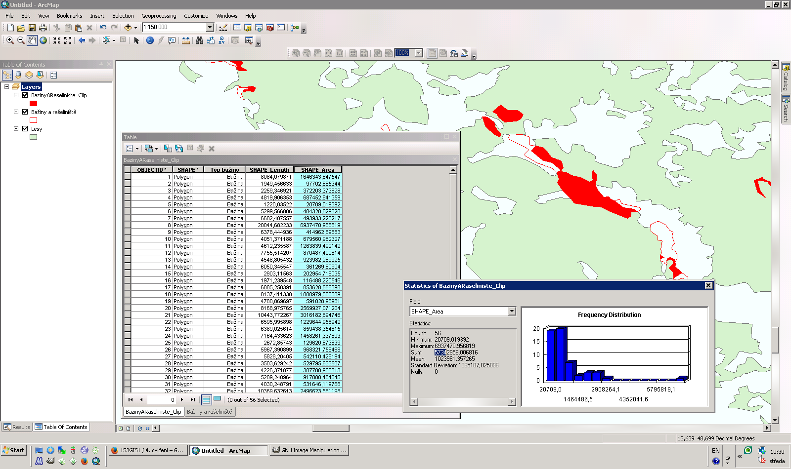
| 30. 10. 2013, 09:32 | Argis-clip.png (soubor) |  |
123 KB | Landa | Řešení první úlohy v ArcGIS {{GIS}} | 1 |
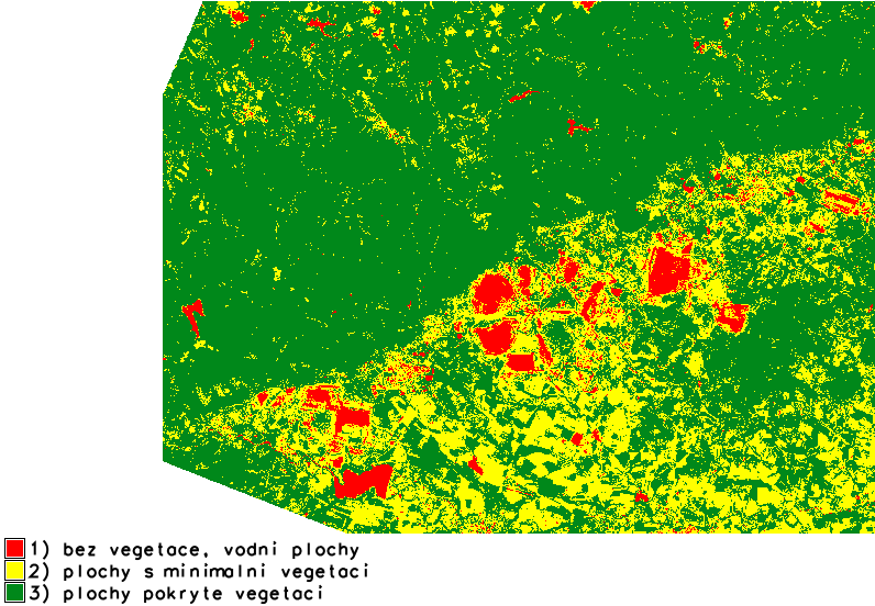
| 15. 10. 2013, 17:48 | ZOD-cv4-r ndvi-leg.png (soubor) |  |
68 KB | Landa | 1 | |
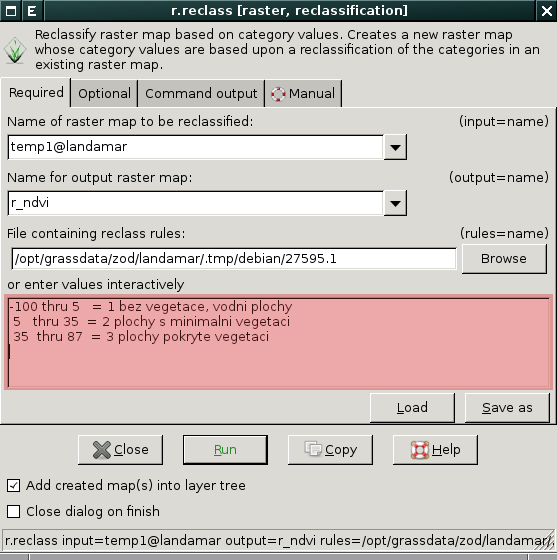
| 15. 10. 2013, 16:10 | Grass-r-reclass.png (soubor) |  |
40 KB | Landa | Definice reklasifikační tabulky v GUI {{GRASS}} | 1 |
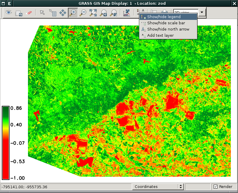
| 15. 10. 2013, 16:04 | Grass-ndvi-legenda.png (soubor) |  |
683 KB | Landa | Zobrazení NDVI a legendy v prostředí wxGUI {{GRASS}} | 1 |
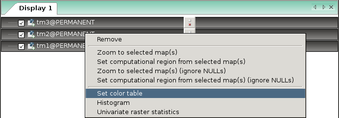
| 15. 10. 2013, 15:10 | Grass-colors-multi.png (soubor) |  |
21 KB | Landa | Nastavení tabulky barev pro více rastrových map v prostředí wxGUI {{GRASS}} | 1 |
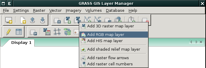
| 15. 10. 2013, 15:07 | Grass-add-rgb.png (soubor) |  |
28 KB | Landa | Přidání barevné syntézy v prostředí wxGUI {{GRASS}} | 1 |
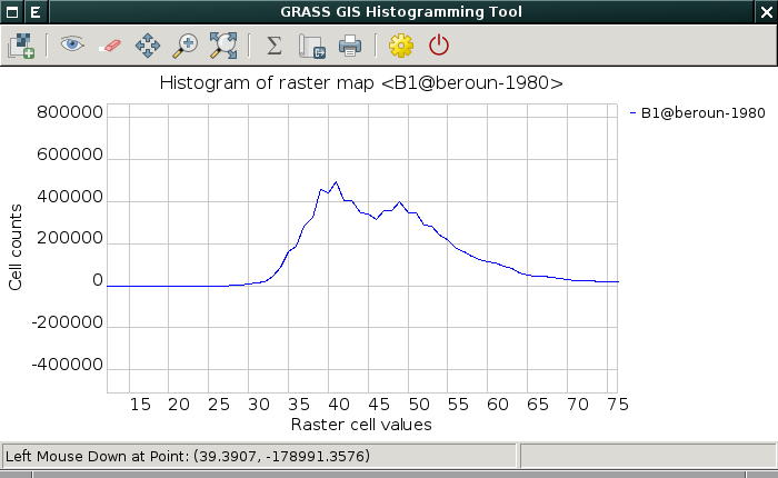
| 15. 10. 2013, 13:34 | Grass-wx-histogram-plot.png (soubor) |  |
27 KB | Landa | 1 | |
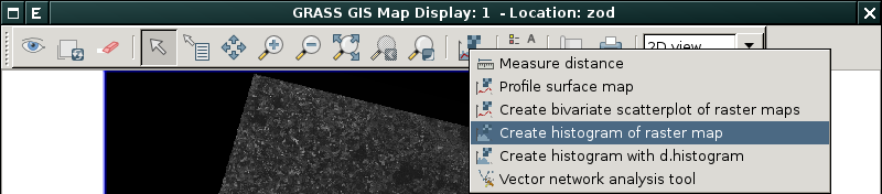
| 15. 10. 2013, 13:10 | Grass-wx-histogram-1.png (soubor) | 56 KB | Landa | Vizualizace histogramu (pomocí nativního nástroje) v prostředí wxGUI {{GRASS}} | 1 | |
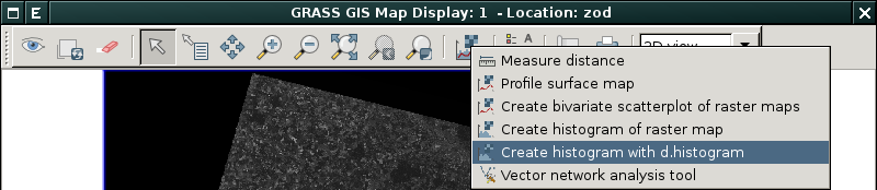
| 15. 10. 2013, 13:03 | Grass-wx-histogram-0.png (soubor) | 55 KB | Landa | 1 | ||
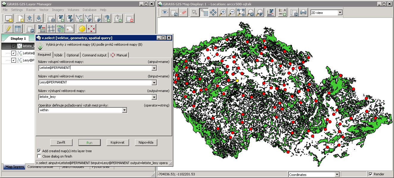
| 8. 10. 2013, 08:38 | Grass-letiste-les.png (soubor) |  |
370 KB | Landa | Řešení první úlohy v systému GRASS {{GRASS}} | 1 |
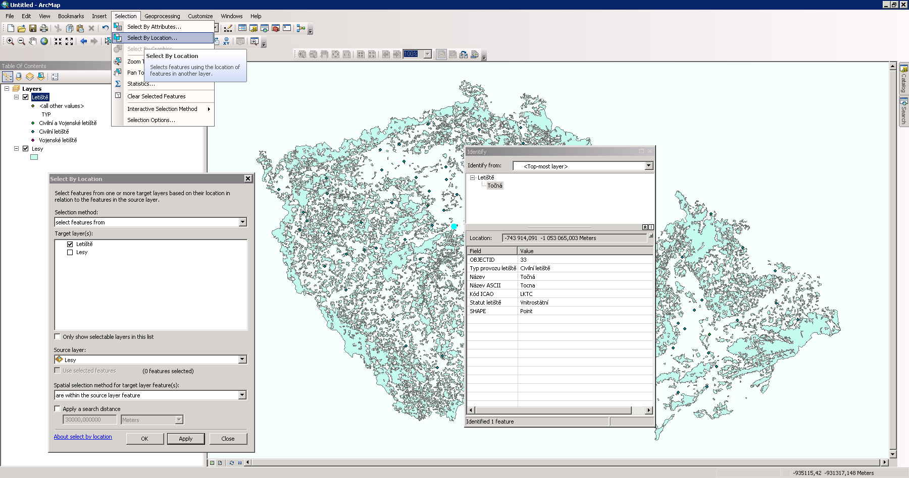
| 8. 10. 2013, 08:26 | Argis-letiste-les.png (soubor) |  |
156 KB | Landa | Řešení první úlohy v ArcGIS {{GIS}} | 1 |
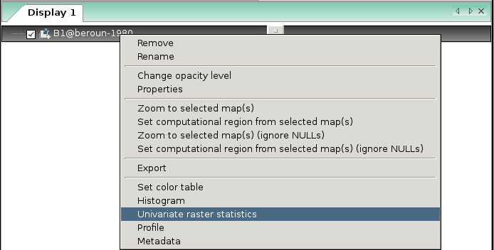
| 7. 10. 2013, 09:21 | Grass-r-univar.png (soubor) |  |
22 KB | Landa | Spuštění modulu r.univar z kontextového menu wxGUI {{GRASS}} | 1 |
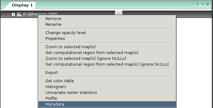
| 7. 10. 2013, 09:15 | Grass-r-info.png (soubor) |  |
22 KB | Landa | Spuštění modulu r.info z kontextového menu wxGUI {{GRASS}} | 1 |
| 7. 10. 2013, 08:40 | Grass-colors-dialog.png (soubor) |  |
145 KB | Landa | Interaktivní určení tabulky barev, dialog je dostupný z menu Raster → Manage colors → Manage color rules interactively {{GRASS}} | 1 |
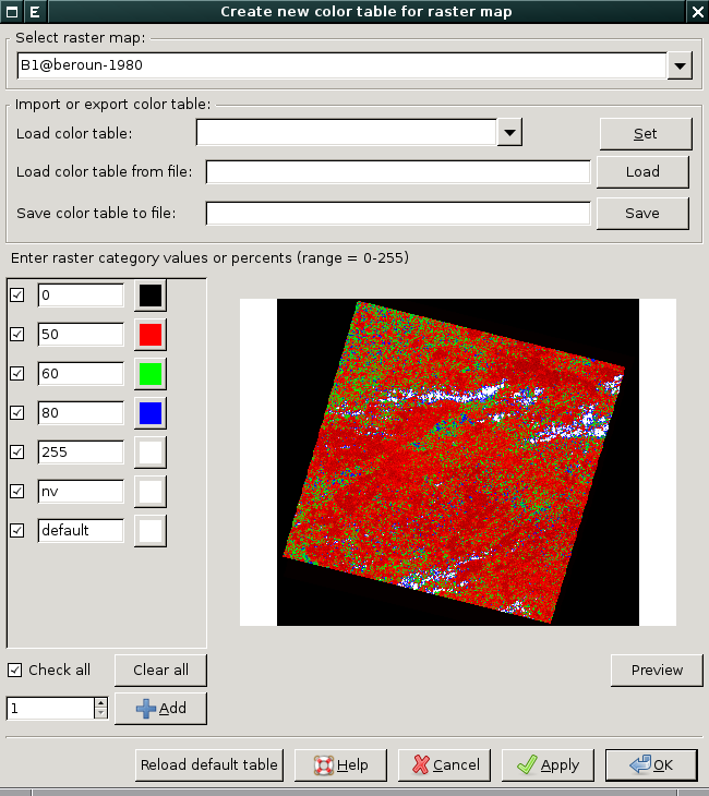
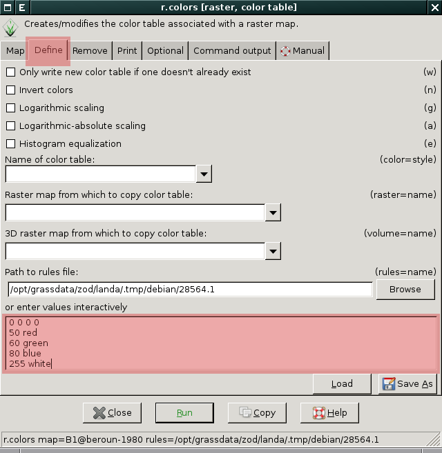
| 7. 10. 2013, 08:38 | Grass-r-colors.png (soubor) |  |
46 KB | Landa | Definice vlastní tabulky barev pomocí modulu r.colors {{GRASS}} | 1 |
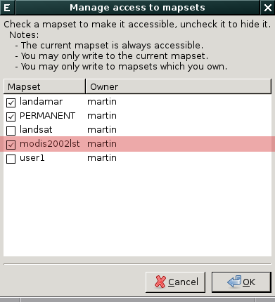
| 3. 10. 2013, 11:33 | Wxgui-mapsets.png (soubor) |  |
18 KB | Landa | Nastavení vyhledávací cesty ve wxGUI {{GRASS}} | 1 |
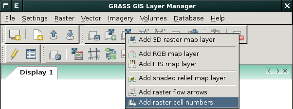
| 2. 10. 2013, 15:55 | Wxgui-d-rast-num.png (soubor) |  |
28 KB | Landa | Spuštění modulu d.rast.num z prostředí wxGUI {{GRASS}} | 1 |
| 2. 10. 2013, 15:34 | ZOD-cv1-wxgui.png (soubor) |  |
146 KB | Landa | 2 | |
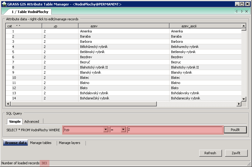
| 1. 10. 2013, 10:03 | Grass-atributy-rybniky.png (soubor) |  |
13 KB | Landa | Řešení první úlohy v systému GRASS {{GRASS}} | 1 |
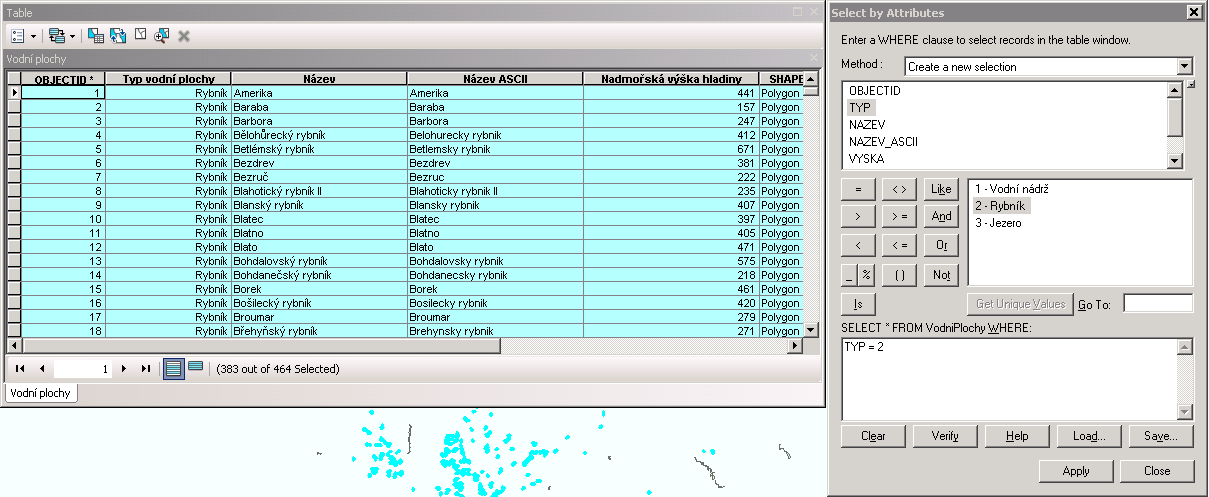
| 30. 9. 2013, 16:06 | Argis-atributy-rybniky.png (soubor) |  |
34 KB | Landa | Řešení první úlohy v ArcGIS {{GIS}} | 1 |
| 29. 9. 2013, 07:57 | Gk-logo.png (soubor) | 8 KB | Landa | Logo | 1 | |
| 16. 9. 2013, 15:01 | GISday13-banner.jpg (soubor) |  |
12 KB | Muller | gis day banner | 1 |
| 13. 6. 2013, 19:11 | Martin Landa.jpg (soubor) |  |
490 KB | Landa | 2 | |
| 23. 3. 2013, 17:57 | Volejbal-gk2013-plakat-170px.jpg (soubor) |  |
12 KB | Soucek | Plakát GK2013 | 1 |
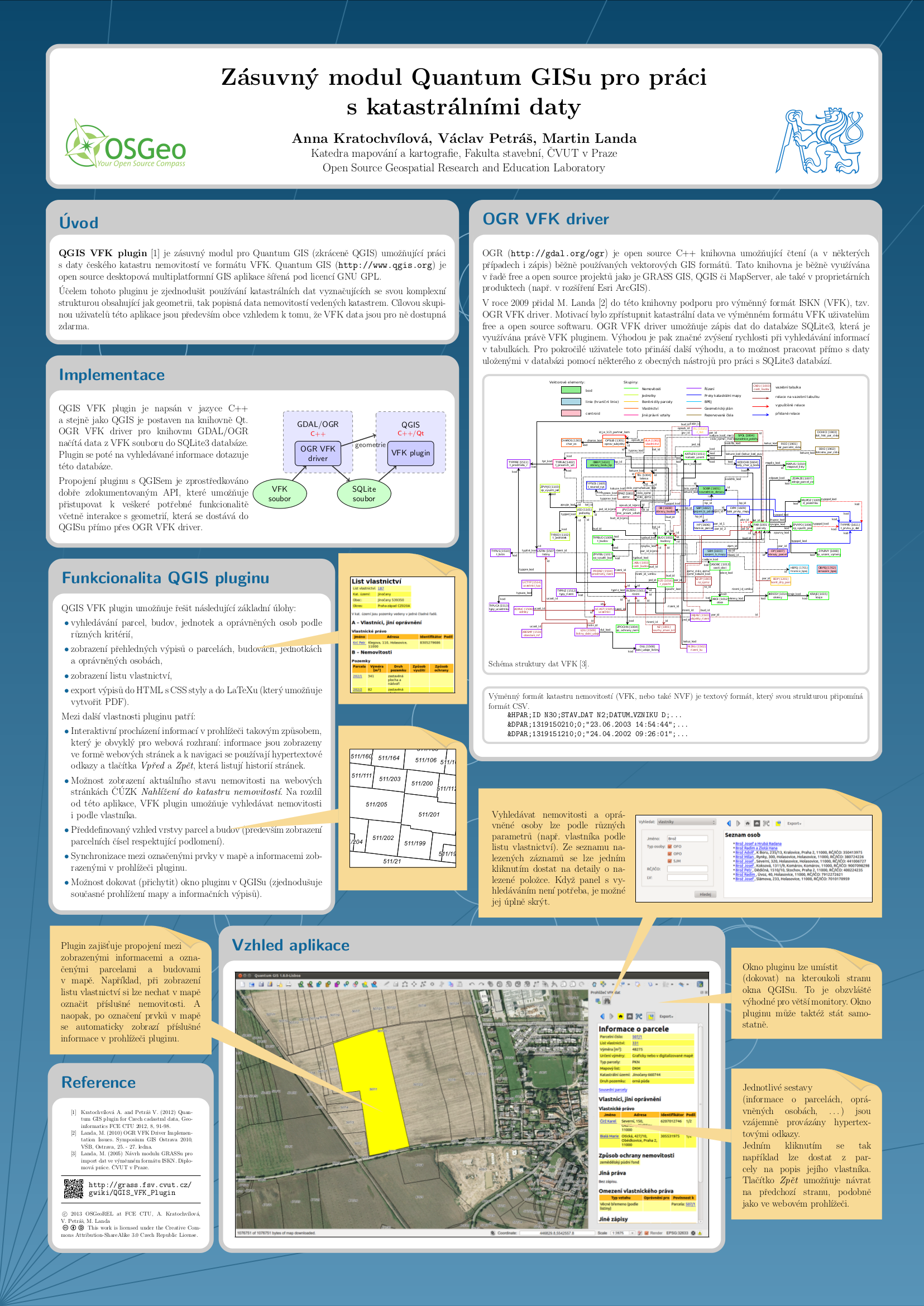
| 9. 3. 2013, 17:11 | Kratochvilova-gisostrava2013-poster.png (soubor) |  |
1,44 MB | Landa | Kratochvilova GIS Ostrava 2013 poster | 1 |
| 9. 3. 2013, 16:56 | Landa-ogrs2012-poster.png (soubor) |  |
1,56 MB | Landa | Landa: OGRS2012 poster | 1 |
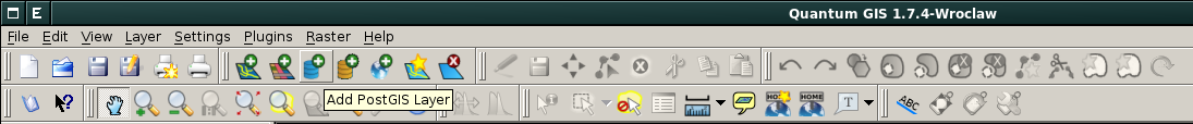
| 19. 2. 2013, 14:30 | Qgis-postgis-toolbar.png (soubor) | 51 KB | Landa | Podpora PostGIS v prostředí QGISu {{GFOSS}} | 1 | |
| 19. 2. 2013, 14:24 | Qgis-postgis-icon.png (soubor) | 1 KB | Landa | QGIS PostGIS icon {{GFOSS}} | 1 |