Open Source Geospatial Research and Education Laboratory

This OSGeo Research and Education Laboratory (OSGeoREL) is located at the Czech Technical University in Prague, Faculty of Civil Enginneering, Department of Geomatics, Czech Republic. Our mission, as one of the laboratories in the OSGeo worldwide network, is to develop collaboration opportunities for academic, industrial, and government organizations in open source GIS software and data (see the announcement and info at GIM).
Our motto • http://sciencecodemanifesto.org
OSGeo/ICA Memorandum of Understanding
The Open Source Geospatial Foundation (OSGeo) and the International Cartographic Association (ICA) have signed a Memorandum of Understanding for developing global open source GIS software and data collaborations for academic, industrial, and government organizations. The MoU aims to provide expertise and support for the establishment of Open Source Geospatial Laboratories and Research Centres across the world for development of open-source geospatial software technologies and training. Laboratories are being established in Asia, Europe, Africa, the Americas and Australasia which will act as nodes for future expansion of the worldwide network.
Global ICA-OSGeo Research and Education Laboratories Network
Courses offered through our study program
- Free Software GIS (available also in English)
- Introduction into Spatial Data Processing (in Czech only)
- Introduction into Remote Sensing Data Processing (in Czech only)
Collaboration with OSGeo projects and Research groups
OSGeo projects:
Research groups:
- Open Source Geospatial Research and Education Laboratory at North Carolina State University Center for Earth Observation, Raleigh, NC, U.S.A.
- GIS and Remote Sensing Unit at Fondazione Edmund Mach, S. Michele all’Adige, Italy
People
- Faculty
- Students
- Tereza Fiedlerová
- Matěj Krejčí
- External collaborators
- Štěpán Turek
- Former students
- Anna Kratochvílová
- Václav Petráš
- Guests
- Eva Stopková (The Slovak University of Technology in Bratislava, Slovakia) • February - April 2013
Projects
Our lab is mostly focused on developing new tools for various open source geospatial software projects.
GRASS GIS
wxGUI is a new generation of graphical user interface for GRASS GIS.
|
|
| umNLISWzTlk|350|center|wxGUI Interactive Scatter Plot Tool}} | oTQ963mC9JE|350|center|wxGUI Animation Tool - both 2D and 3D view}} |
|
|
| McOrMauPc_I|350|center|wxGUI Vector Network Analysis Tool}} | vfNw4SAP2Uc|350|center|WMS support in wxGUI}} |
|
|
| FyzfdlkTNRg|350|center|wxGUI tool for supervised classification of imagery data}} | ZMwuC14omyA|350|center|wxGUI Cartographic Composer}} |
|
|
| 0jkO-ih87mw|350|center|wxGUI Graphical Modeler}} | ib1-mBbWkv4|350|center|wxGUI 3D viewer}} |
GDAL/OGR
- OGR VFK driver (in English)
- Author: Martin Landa
QGIS
|
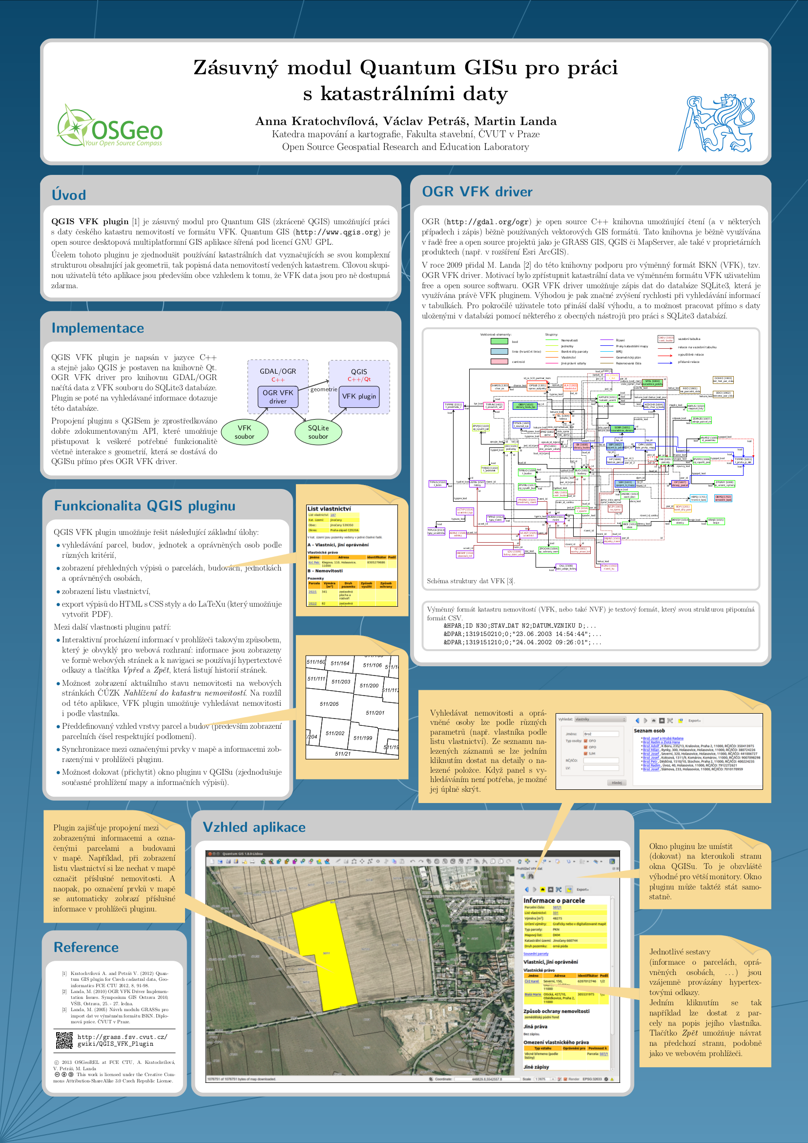
| zIqmMgb8708|350|center|QGIS VFK Plugin}} |
Publications
Papers
<bibtex> @article{neteler-metz-bowman-landa.2012:Elsevier,
 author = {Markus Neteler and M. Hamish Bowman and Martin Landa and Markus Metz},
 title = {GRASS GIS: A multi-purpose open source GIS},
 journal = {Environmental Modelling & Software},
 year = {2012},
 volume = {31},
 month = {May},
 pages = {124-130},
 url = {http://gis.cri.fmach.it/uploads/neteler_grass_env_model_software.pdf},
 language = {English}
} </bibtex>
<bibtex> @article{kratoch.qgis.2012,
AUTHOR  = {Anna Kratochvílová and Václav Petráš},
TITLE   = {Quantum GIS plugin for Czech cadastral data},
JOURNAL = {Geoinformatics FCE CTU},
YEAR    = {2012},
VOLUME  = {Vol. 8},
MONTH   = {October},
issn    = {1802-2669},
pages   = {91-98},
url     = {http://geoinformatics.fsv.cvut.cz/pdf/geoinformatics-fce-ctu-2012-08.pdf},
keywords = {studentske},
} </bibtex>
<bibtex> @InProceedings{landa-cepek.2010:FOSS4G2010,
 author = {Martin Landa and Aleš Čepek},
 title = {Learning PostGIS using Sqltutor},
 booktitle = {FOSS4G 2010 Barcelona},
 year = {2010},
 month = {September 6-9},
 url = {http://geo.fsv.cvut.cz/~landa/publications/2010/foss4g-2010/paper/landa-cepek-sqltutor.pdf},
 language = {English},
} </bibtex> <bibtex> @InProceedings{landa.2010:GO10,
 author = {Martin Landa},
 title = {OGR VFK Driver Implementation Issues},
 booktitle = {Symposium GIS Ostrava 2010},
 year = {2010},
 month = {January 25-27},
 url = {http://geo.fsv.cvut.cz/~landa/publications/2010/gis-ostrava-2010/paper/landa-ogr-vfk.pdf},
 language = {English},
} </bibtex>
Diploma theses
<bibtex> @mastersthesis{turek.dp,
 author = {Štěpán Turek},
 title = {Implementation of bundle block adjustment method for determination of exterior orientation into GRASS GIS},
 school = {Fakulta stavební ČVUT v Praze},
 year = {2014},
 url = {http://geo.fsv.cvut.cz/proj/dp/2014/stepan-turek-dp-2014.pdf},
} </bibtex> <bibtex> @mastersthesis{fiedlerova.bp,
 author = {Tereza Fiedlerová},
 title = {Zásuvný modul QGIS pro slučování vektorových dat},
 school = {Fakulta stavební ČVUT v Praze},
 year = {2013},
 url = {http://geo.fsv.cvut.cz/proj/bp/2013/tereza-fiedlerova-bp-2013.pdf},
} </bibtex> <bibtex> @mastersthesis{kratochvilova.dp,
 author = {Anna Kratochvílová},
 title = {Visualization of Spatio-Temporal Data in GRASS GIS},
 school = {Faculty of Civil Engineering, Czech Technical University in Prague},
 year = {2013},
 url = {http://geo.fsv.cvut.cz/proj/dp/2013/anna-kratochvilova-dp-2013.pdf},
} </bibtex> <bibtex> @mastersthesis{turek.bp,
 author = {Štěpán Turek},
 title = {Implementace podpory WMS do programů GRASS GIS a SGA GIS},
 school = {Fakulta stavební ČVUT v Praze},
 year = {2012},
 url = {http://geo.fsv.cvut.cz/proj/bp/2012/stepan-turek-bp-2012.pdf},
 keywords = {studentske},
} </bibtex> <bibtex> @mastersthesis{ruzicka.dp,
 author = {Zdeněk Růžička},
 title = {Workflow Builder pro Quantum GIS},
 school = {Fakulta stavební ČVUT v Praze},
 year = {2012},
 url = {http://geo.fsv.cvut.cz/proj/dp/2012/zdenek-ruzicka-dp-2012.pdf},
 keywords = {studentske},
} </bibtex> <bibtex> @mastersthesis{kratochvilova.bp,
 author = {Anna Kratochvílová},
 title = {Grafické uživatelské rozhraní pro tvorbu mapových výstupů v systému GRASS},
 school = {Fakulta stavební ČVUT v Praze},
 year = {2011},
 url = {http://geo.fsv.cvut.cz/proj/bp/2011/anna-kratochvilova-bp-2011.pdf},
</bibtex>
Posters
 |
 |
| OGRS 2012, PDF | GIS Ostrava 2013, PDF |
Presentations
- (2013-04-13) Seminar: Advances in GIS data processing and management at Fondazione Edmund Mach, Italy
- (2013-07-12) Geoinformatics 2013, CTU in Prague, Czech Republic
- Fiedlerova T.: QGIS plugin for vector conflation
